Flight Paths
The majority of aircraft using Jandakot Airport fly under Visual Flight Rules (VFR). There are designated routes for VFR aircraft to ensure that VFR traffic remains separate from aircraft flying under Instrument Flight Rules (IFR). It is not mandatory that VFR aircraft fly these routes, but many do, especially as they approach or depart airports.
These routes are outside controlled airspace (“OCTA”), that is, aircraft are not being directed by air traffic control. Whenever they fly outside controlled airspace, pilots are following the rules of the air. More information about airspace is found here.
VFR routes include defined entry and exit points to and from controlled airspace. These are landmarks that are easily seen by the pilot from the air. These landmarks are highlighted in the images below, which also show the average percentage of arrivals or departures that use the route.
There is no minimum altitude for aircraft in the process of landing. Aircraft will generally descend on a glide slope of three degrees.
The altitude of aircraft after departure will depend on factors such as the type of aircraft and its weight, how heavily laden it is with fuel and passengers, and the atmospheric conditions at the time. All these factors affect an aircraft’s climb rate. There is no regulated minimum altitude for an aircraft in the process of taking off.
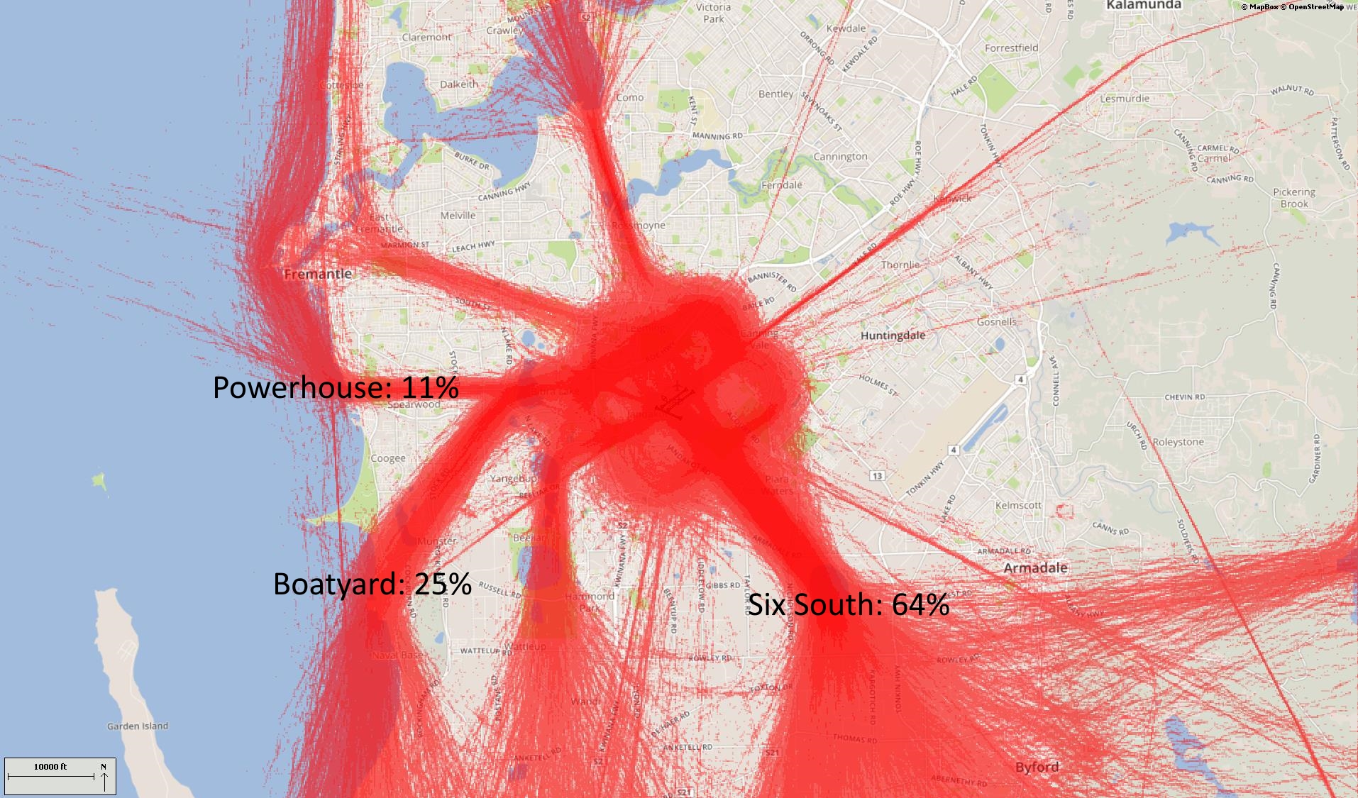
The main inbound tracks are via Canning Bridge, Forrestdale Lake and Adventure World.
The inbound route from the south begins at the boatyard at Henderson where aircraft need to be at 1500 feet. Aircraft then track to Adventure World.
For aircraft arriving from the north-east and east, from Canning Dam aircraft track to a point near Forrestdale Lake while descending to 1500 feet. This keeps them under the Perth Airport Control Area.
From the north-west, aircraft will fly down the coast from around Two Rocks by which time they must be below 4500 feet. Aircraft must remain over water to separate them from outbound aircraft which will track over land. They must be below 4000 feet by Cervantes and 2000 feet by Lancelin. Approaching Mullaloo Pont aircraft must descend to below 1500 feet to remain clear of controlled airspace. They will turn inland at the South Fremantle Power Station and track to Adventure World, maintaining 1500 feet.
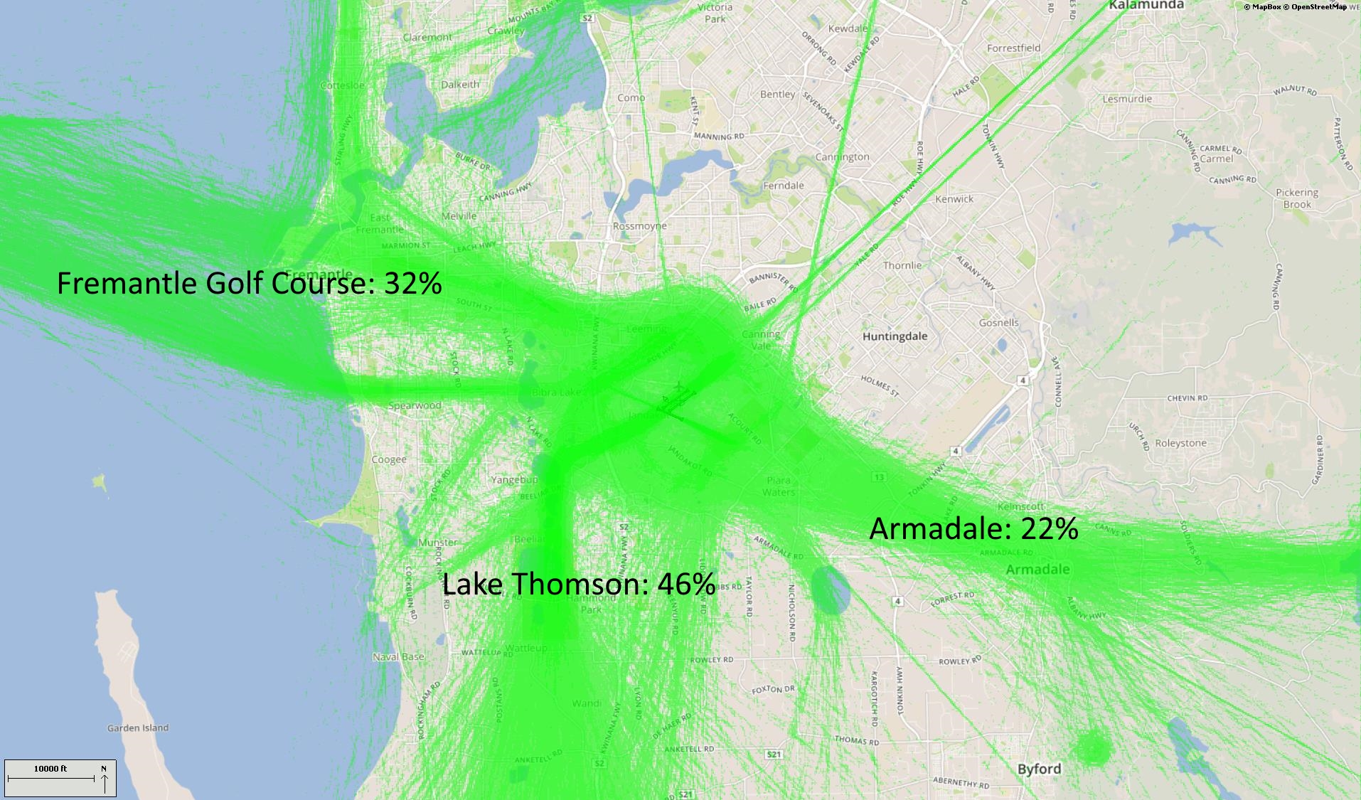
The main departure routes from Jandakot are northwest via the Fremantle Golf Course, southeast via Armadale and south towards the Training Area, via Yangebup and Thompson Lakes.
Outbound aircraft for the north-west track along the coast remaining over land to avoid the inbound route over the water. They must maintain the departure altitude of 1000 feet until over Murdoch University Open Space so as not to conflict with arrivals via Adventure World which are at 1500 feet. At that point they can climb to 1500 feet, but not above or they will infringe controlled airspace. After tracking to Fremantle Golf Course they either proceed to Rottnest Island at 1500 feet, or turn north.
Aircraft heading south will track via Yangebup Lake and Lake Thomson. If departing Runway 06 Left, they will make a left-hand turn and follow the railway line to the south-west in order to remain clear of traffic that may be on the base leg of the circuit. Once past the junction of the railway line and Kwinana Freeway they will track to Lake Yangebup. Aircraft then track via the eastern shoreline of the lakes and maintain the altitude of 1000 feet. Once past Casuarina Prison aircraft can climb up to 6000 feet.
The route for aircraft outbound to the east is via Armadale. One thousand feet must be maintained until abeam Forrestdale Lake to ensure separation from arriving aircraft at 1500 feet. From Armadale aircraft must remain below 3500 feet as they track towards Canning Dam.
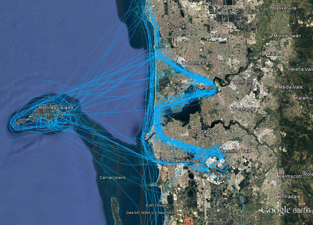
There is an established scenic route through Perth Airport’s controlled airspace via Fremantle Golf Course. Some flights will combine the scenic route with a visit to Rottnest Island, as can be seen in the image, right. Click to enlarge the image and use your browser “back” button to return to this page.
The route will vary depending on movements in and out of Perth Airport. It is either a right-hand turn towards the city at Cottesloe, or air traffic control may require the aircraft to fly further north past Cottesloe and City Beach before turning right and flying the route in reverse.
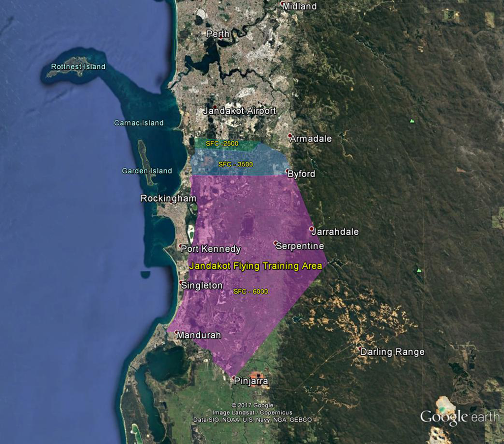
Designated training areas have been established by the Civil Aviation Safety Authority for flight training. For Jandakot Airport these exist to the south of the airport. Once pilots progress past the circuit training stage of their courses they will begin flying to and around the training area.
Click to enlarge the training area image, right, and use your browser “back” button to return to this page.
Aircraft do not require a clearance from air traffic control to operate within the training areas because they are outside controlled airspace.
Three connected pieces of airspace comprise the training area. The first starts about 7km south of the airport and exists from the surface (“SFC”) up to 2500 feet. South of this the upper level rises to 3500 feet and then to 6000 feet. The training area extends south to Mandurah and Pinjarra then up to Serpentine Dam and up to the Byford area.
Low level aerobatics is also allowed in a number of areas, around Murray Field, Serpentine, and north of Mundijong.
Aircraft tracking to the training areas will track via Yangebup Lake and Lake Thomson. Tracking from the training areas to the airport the aircraft will either track coastal over Lake Coogee or via Forrestdale Lake.
There is also a helicopter training area on the airport directly to the east of Runway 06R / 24L. At times there may also be helicopter training to the south of Runway 12/30.
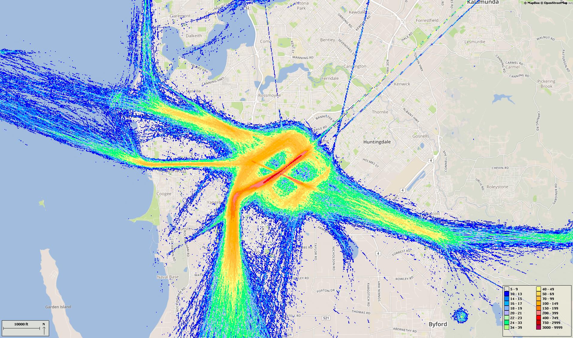
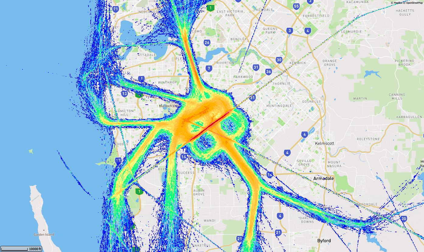
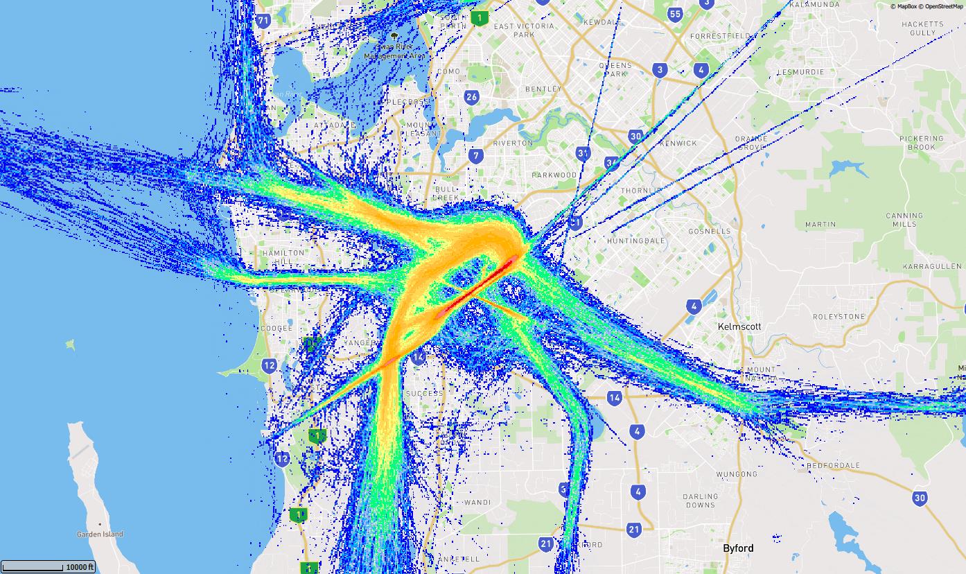
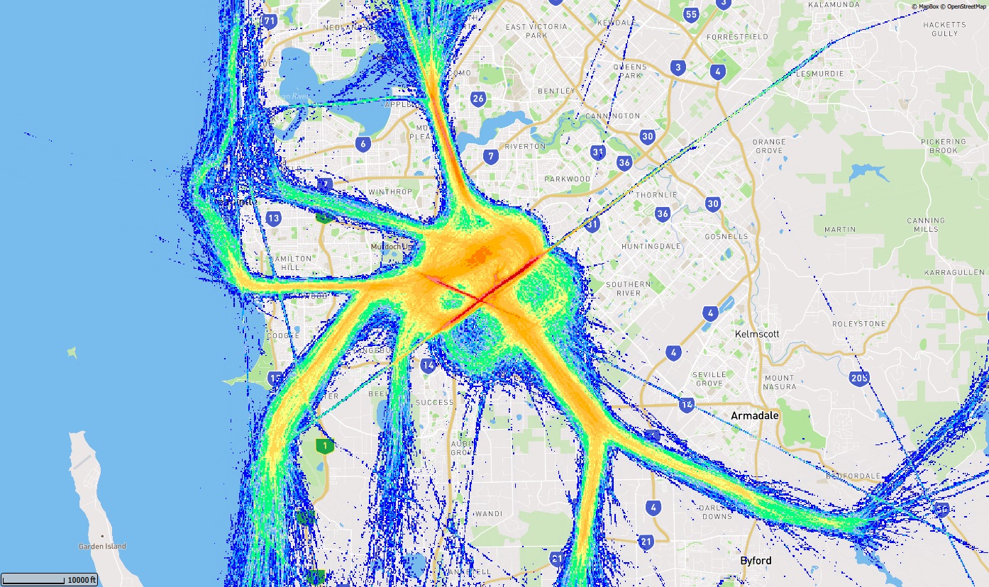
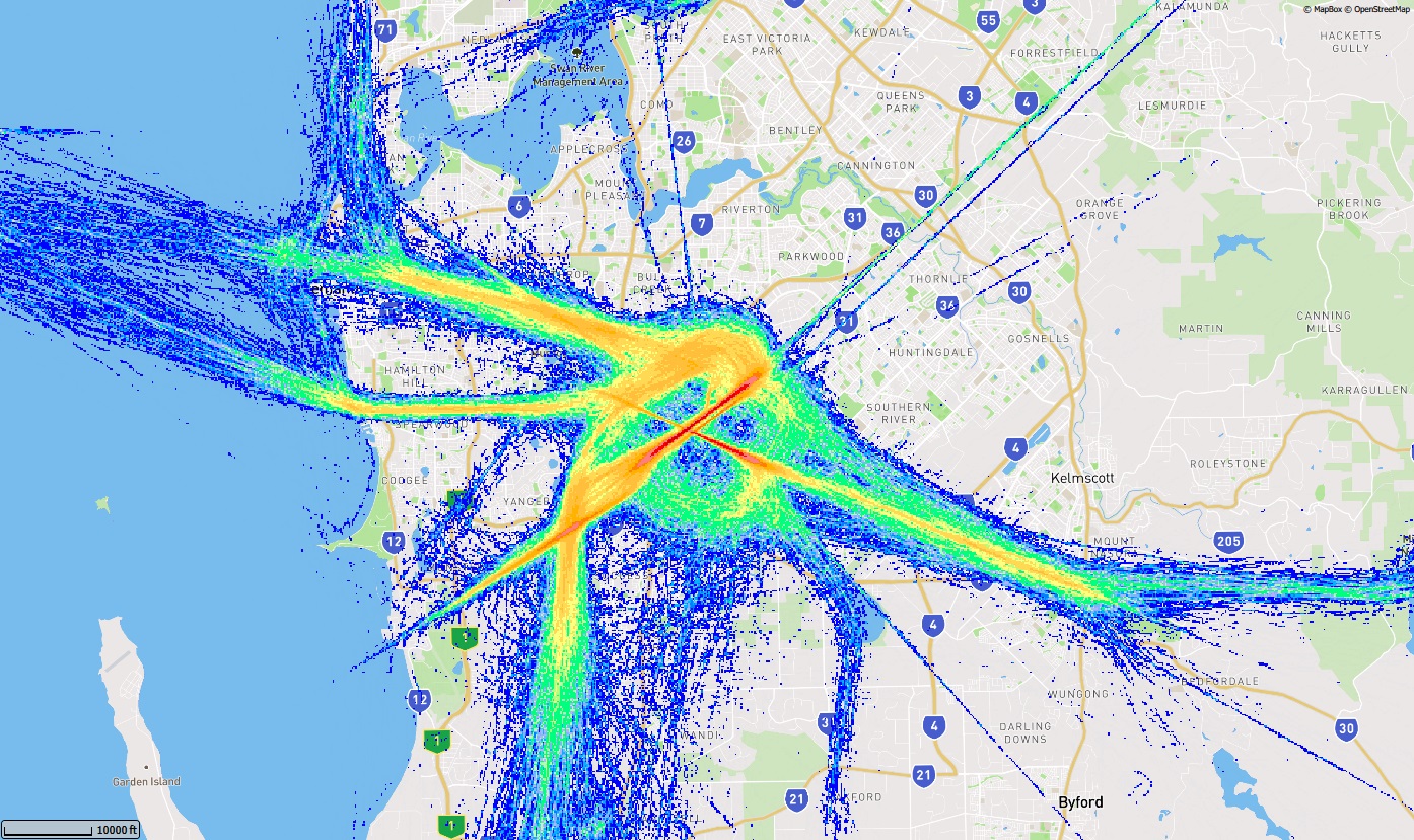
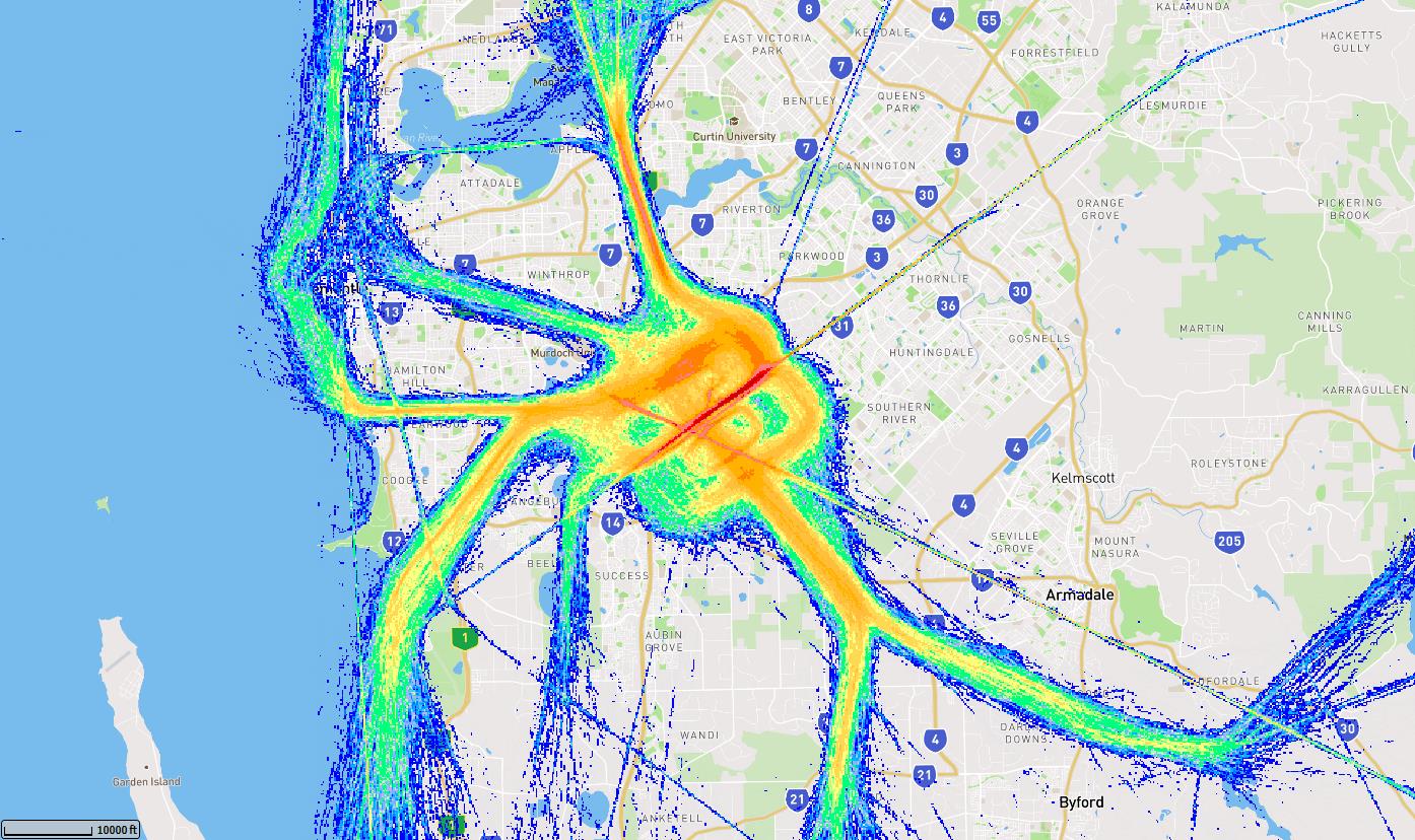
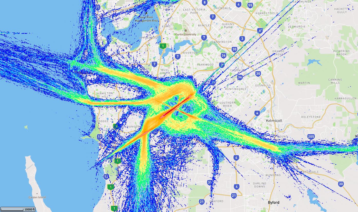
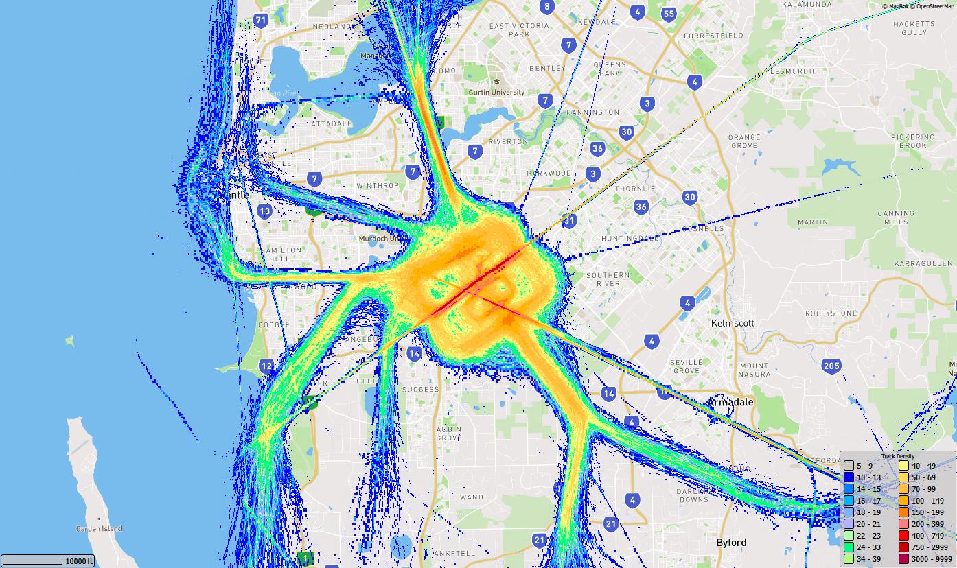
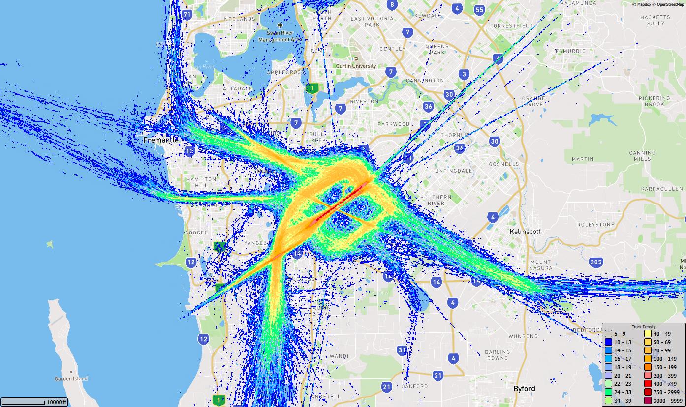
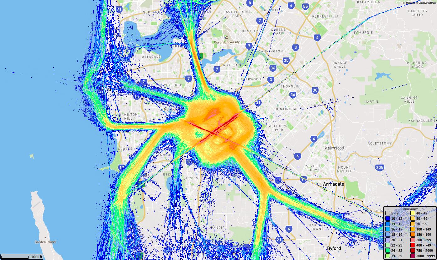
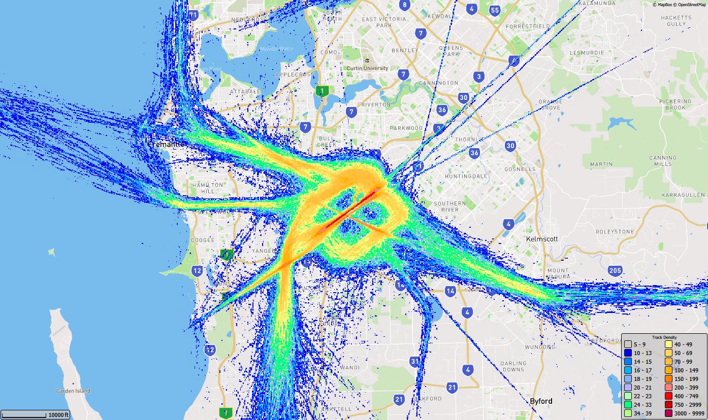
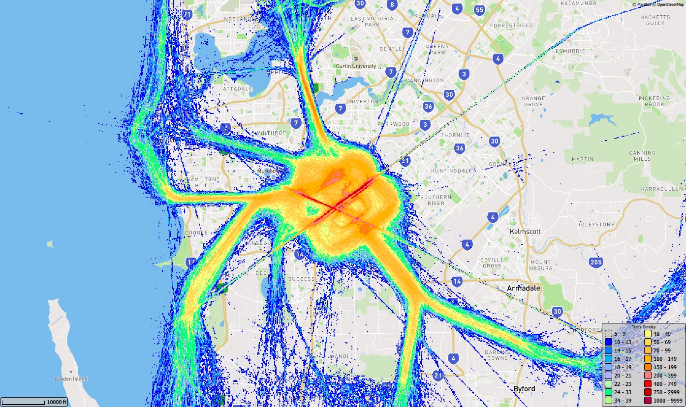
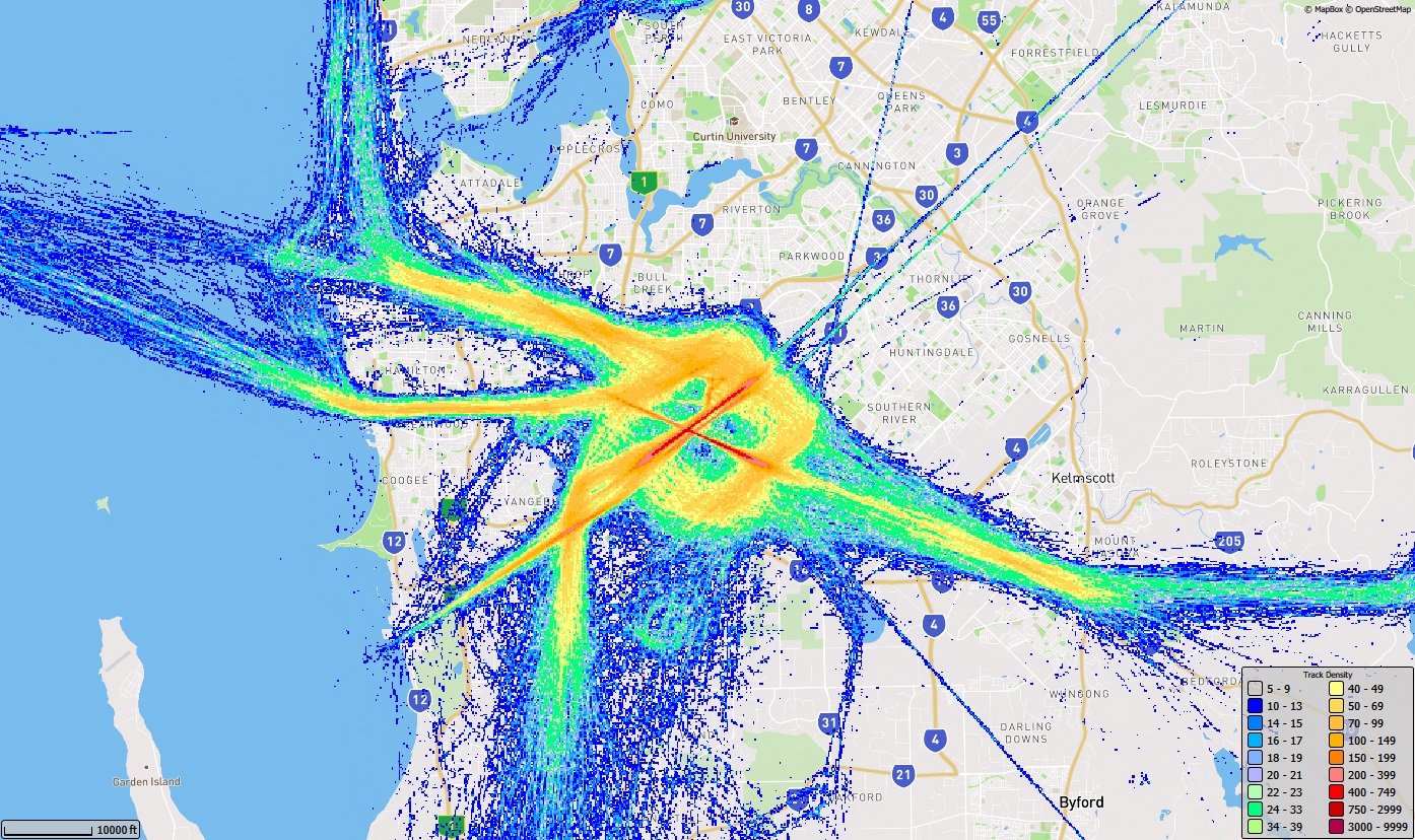
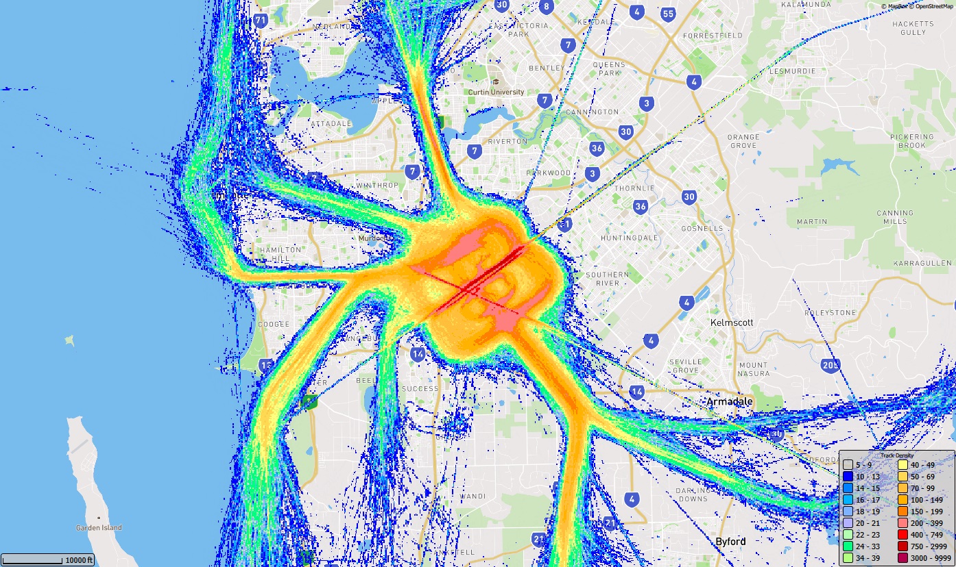
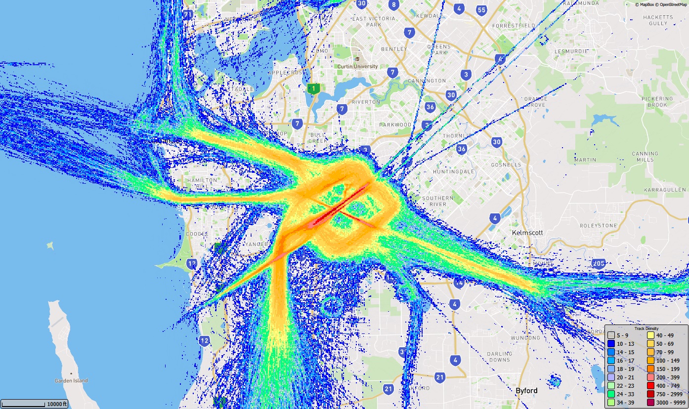
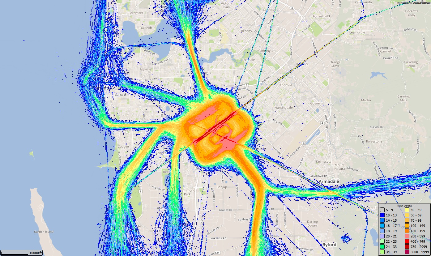
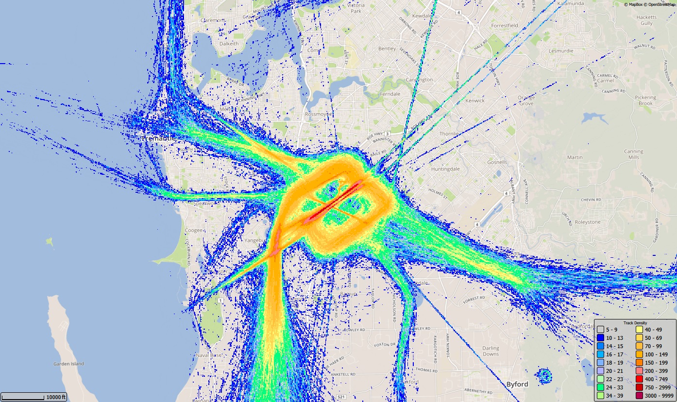
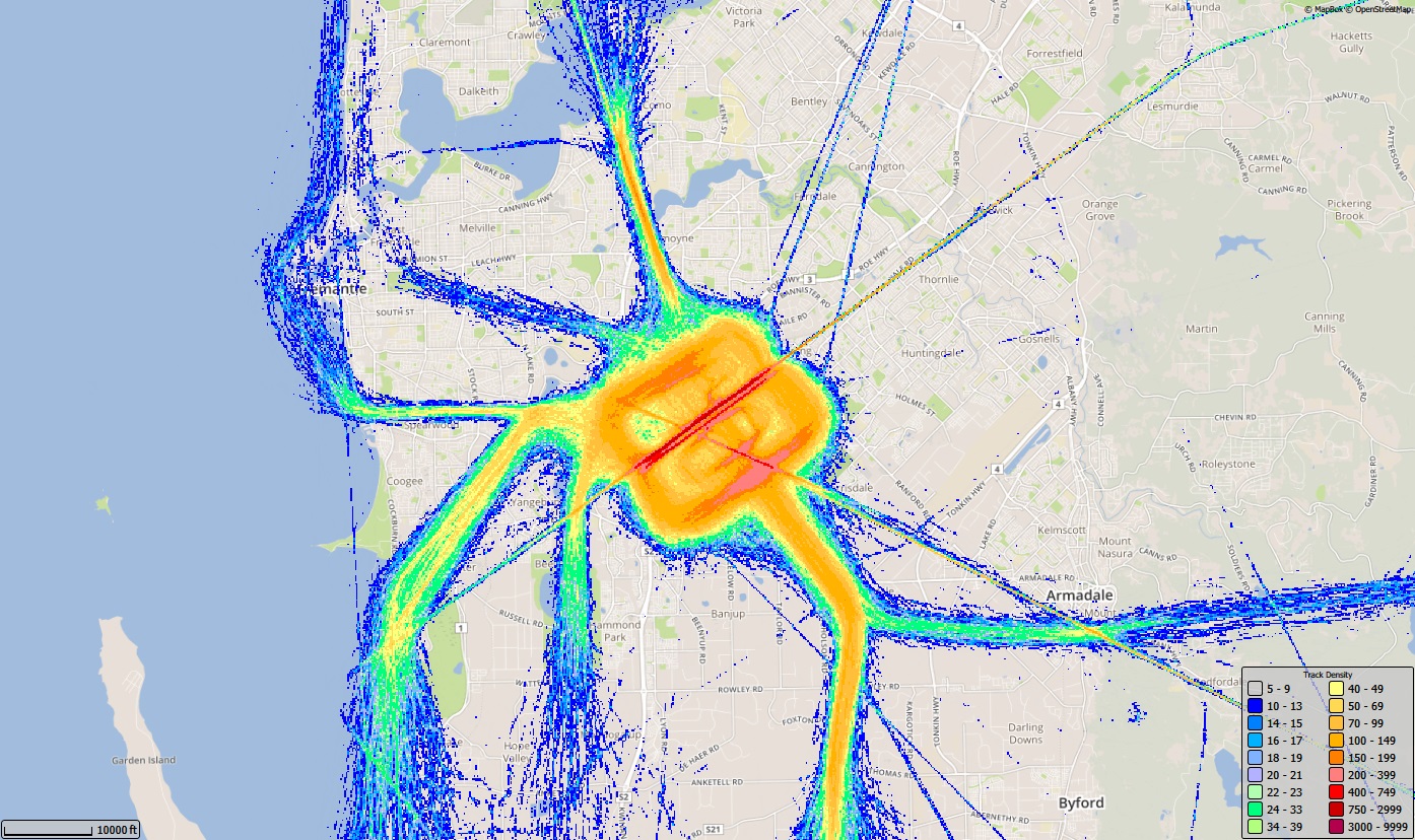
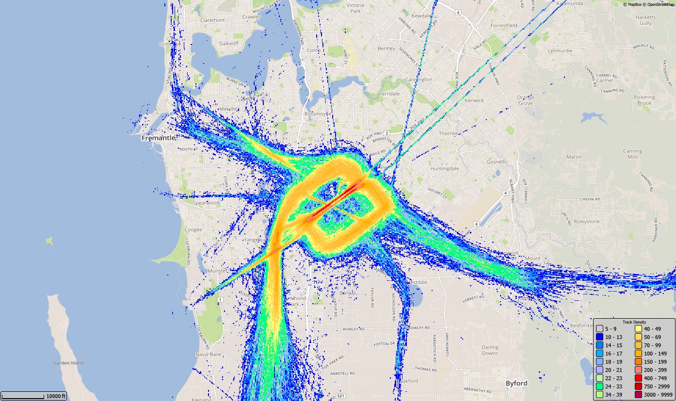
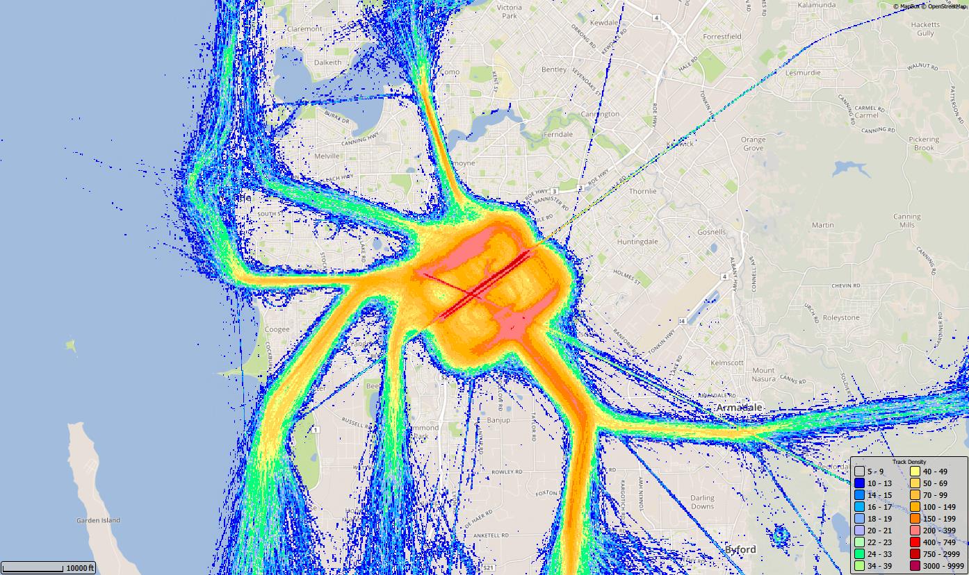
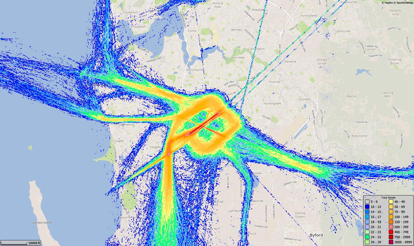
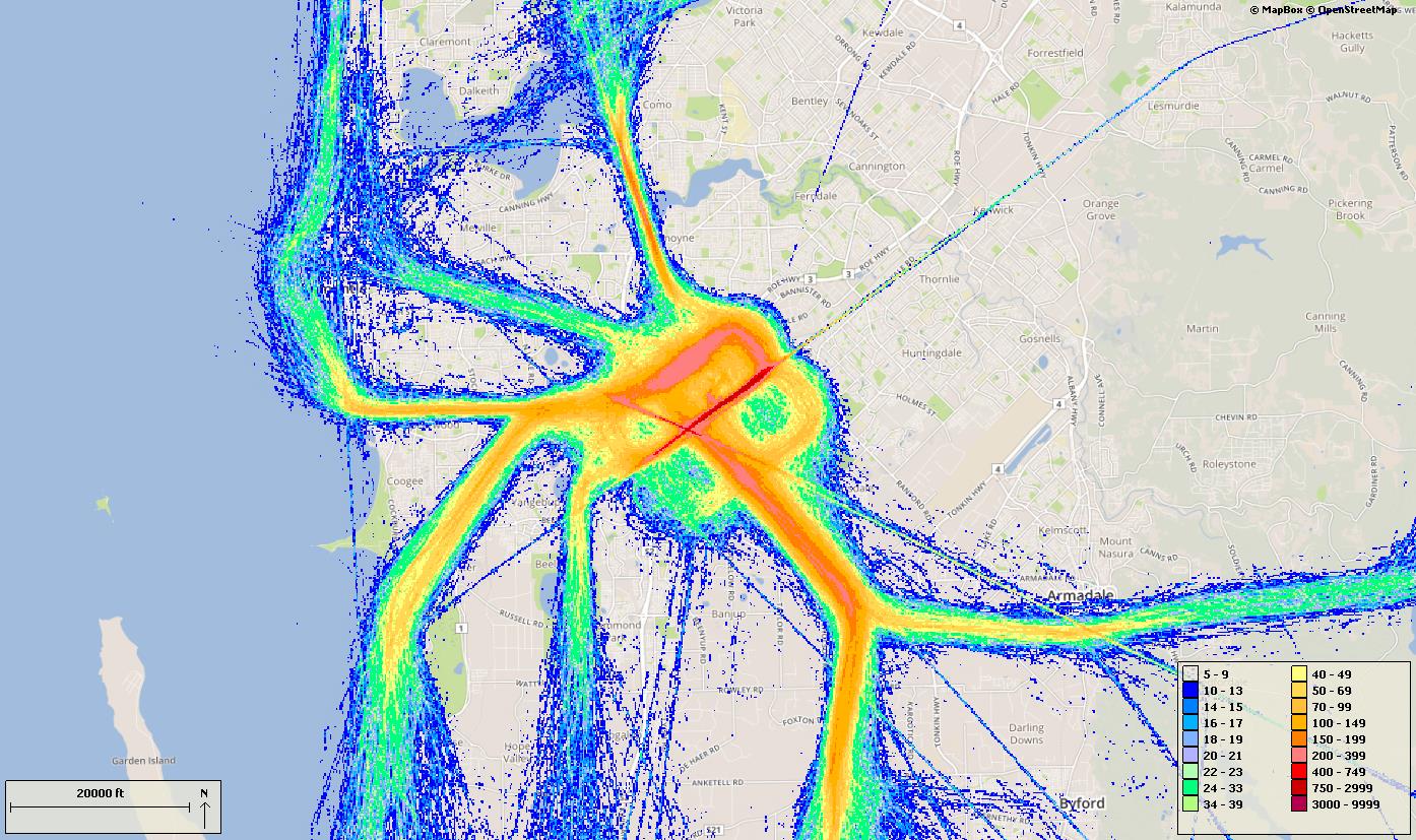
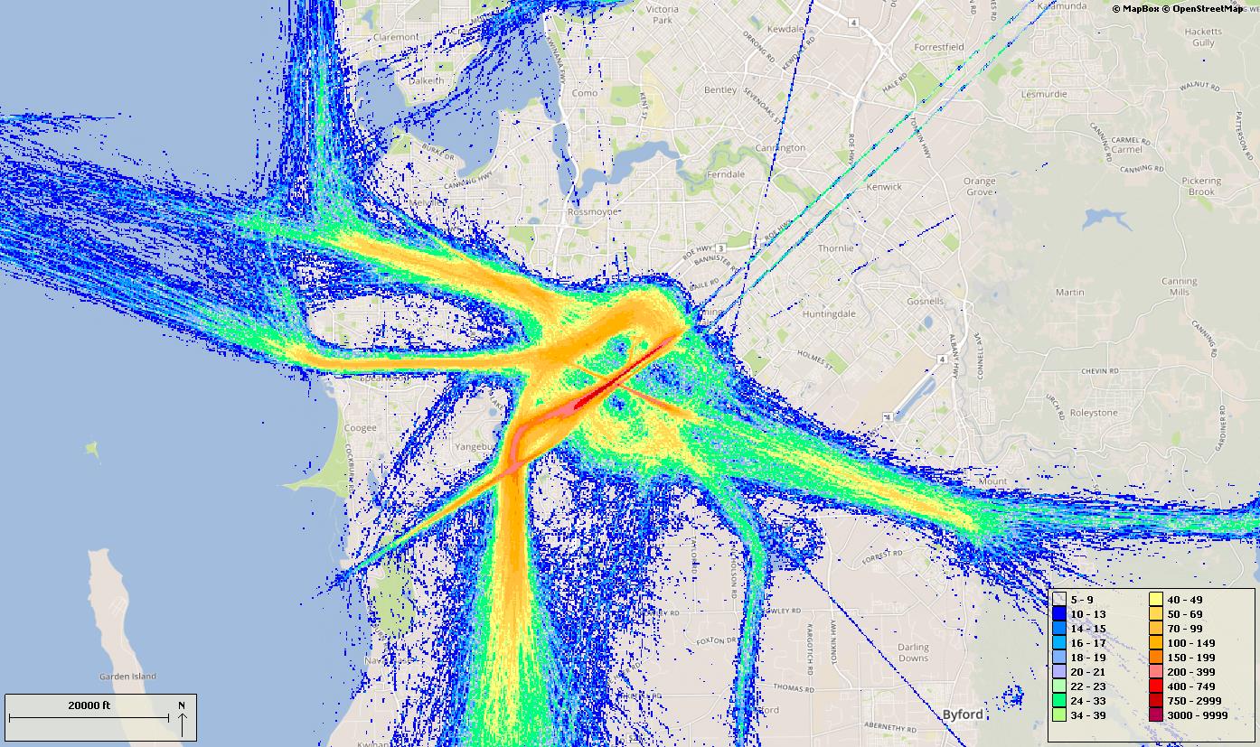
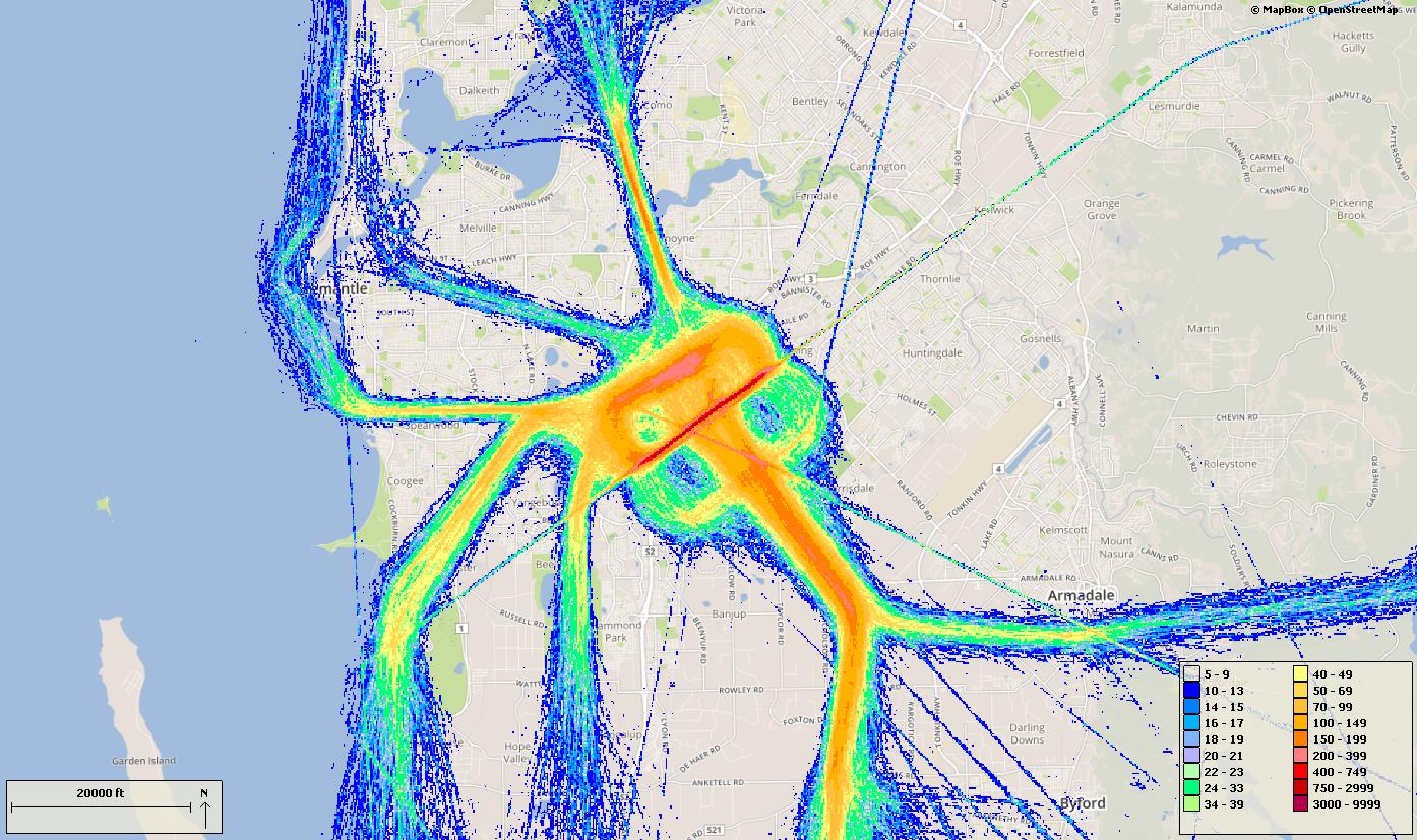
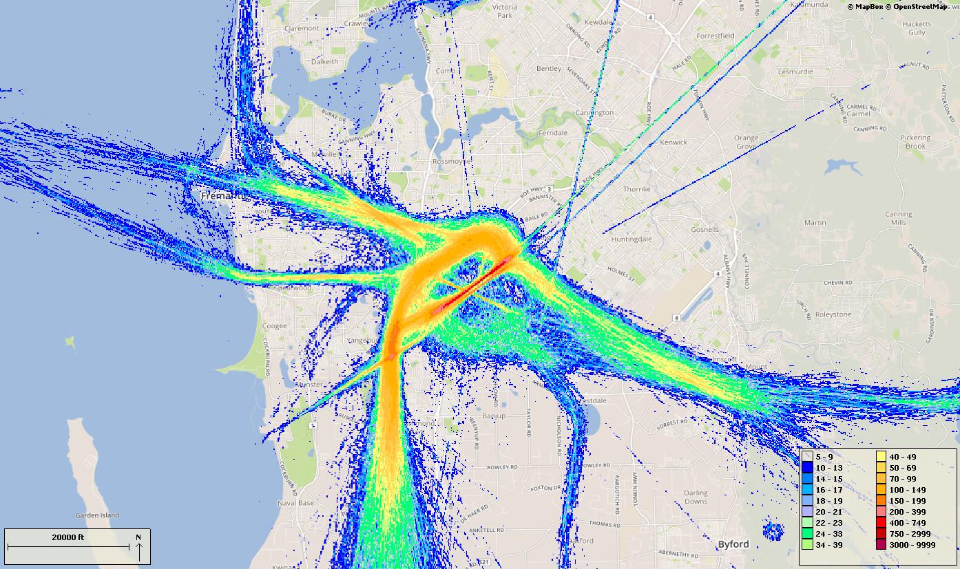
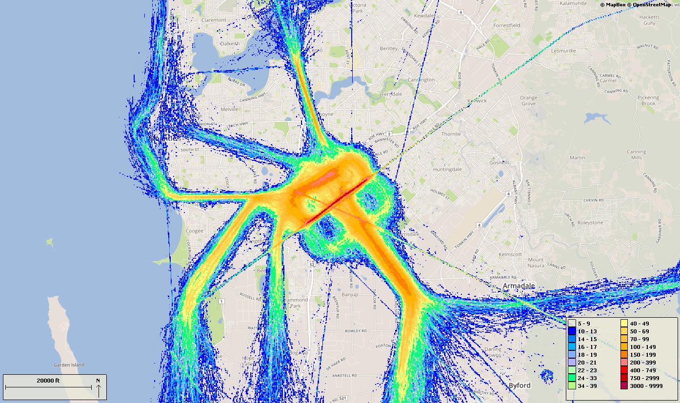
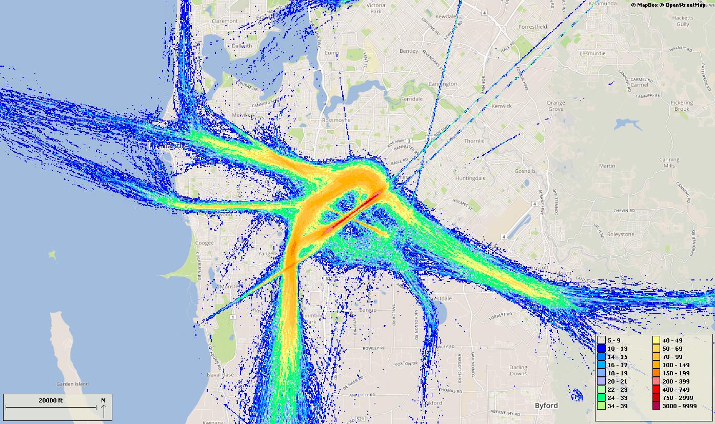
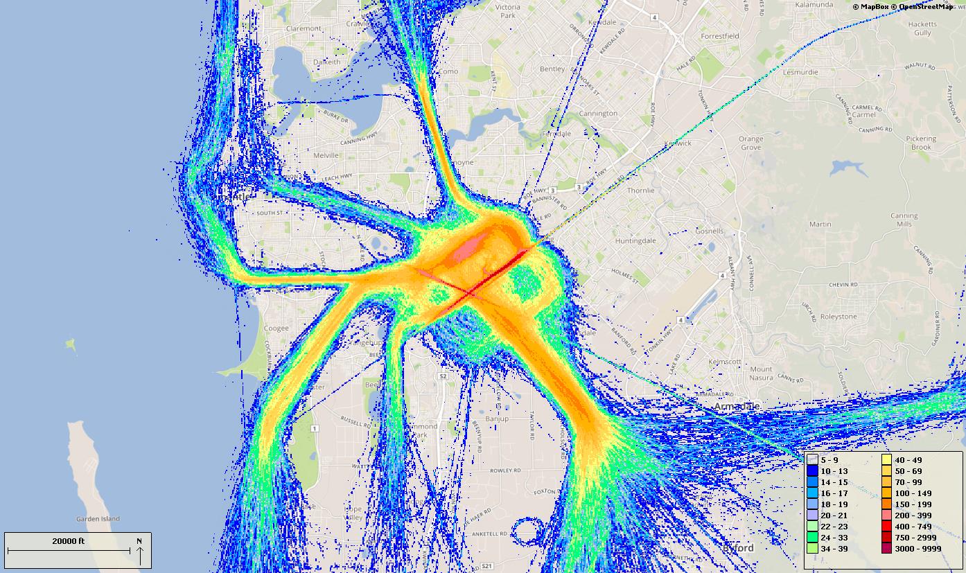
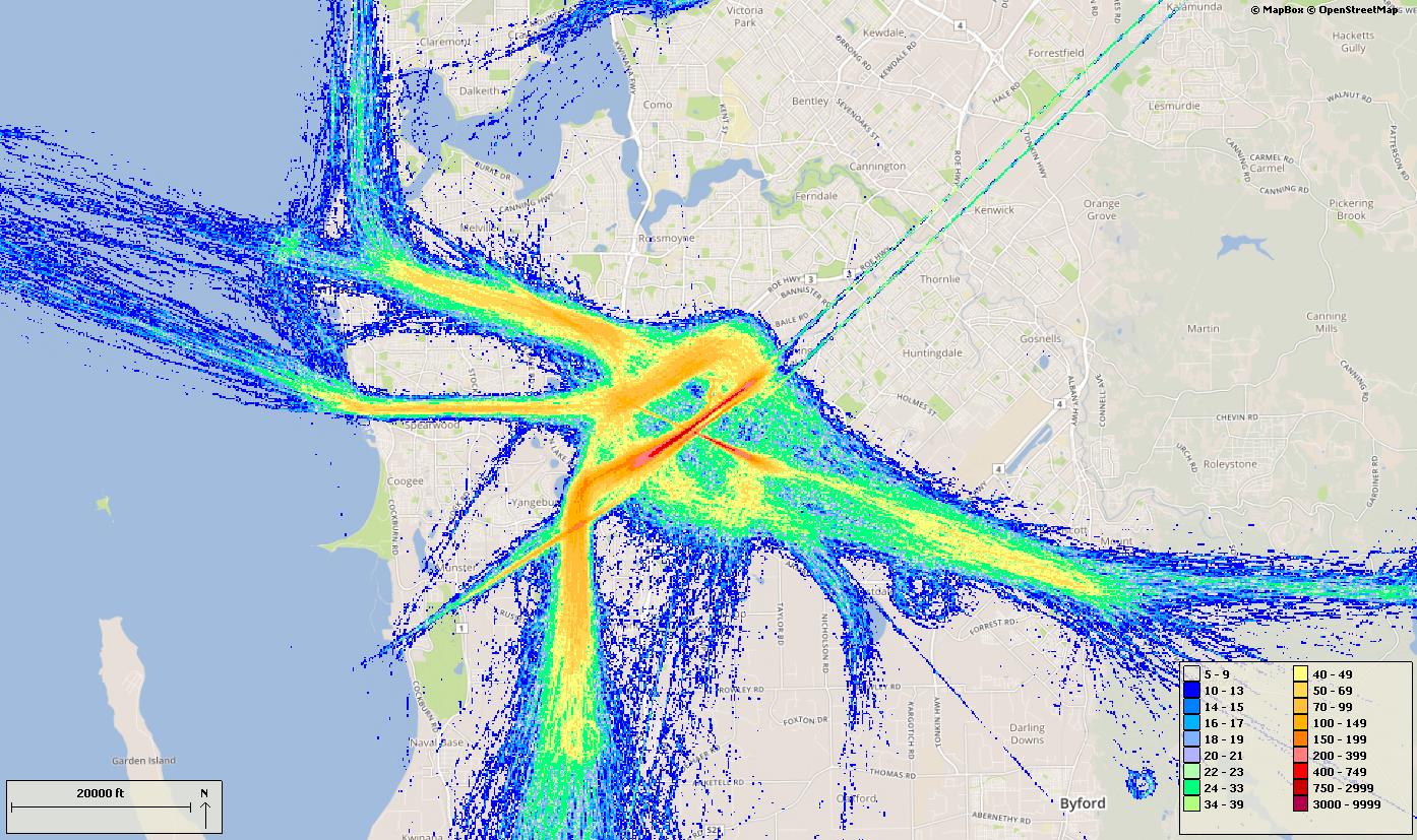
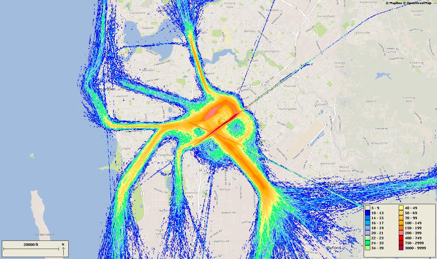
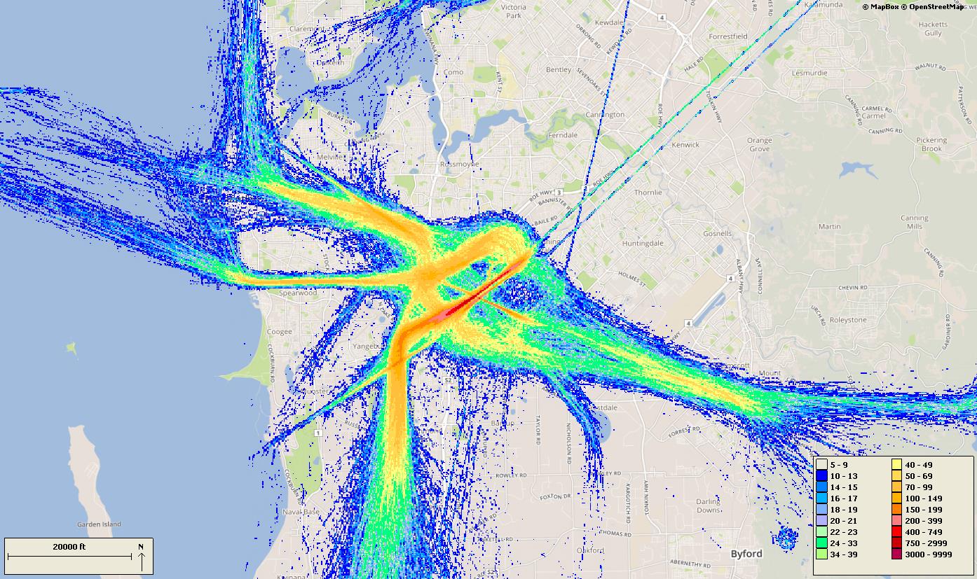
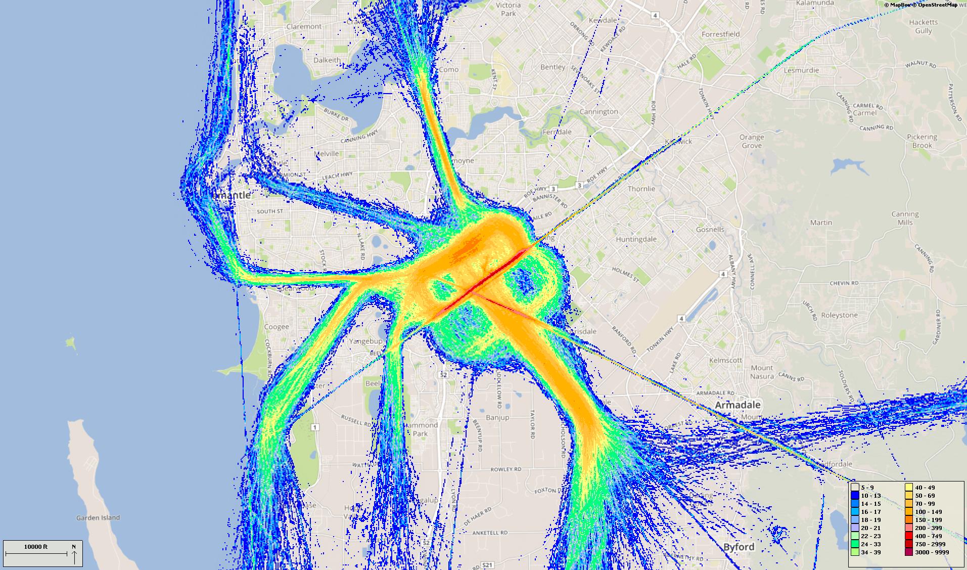
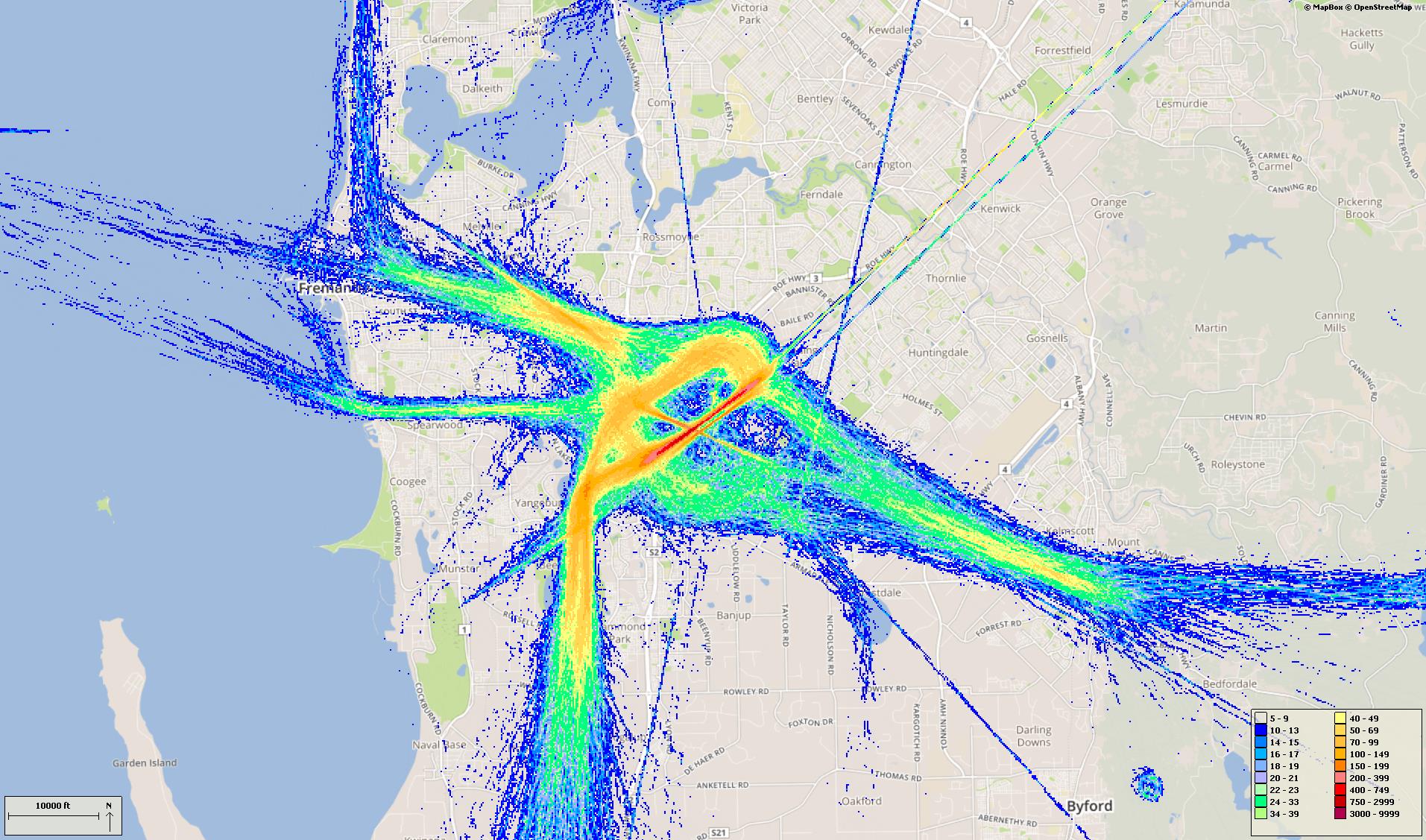
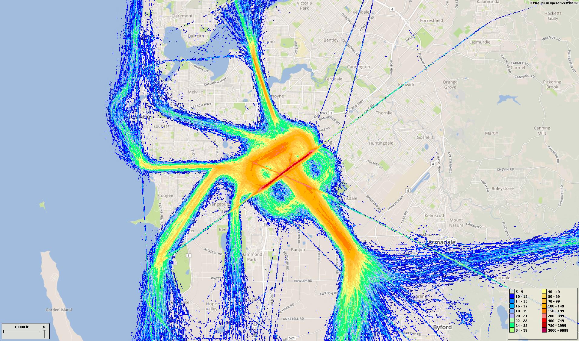
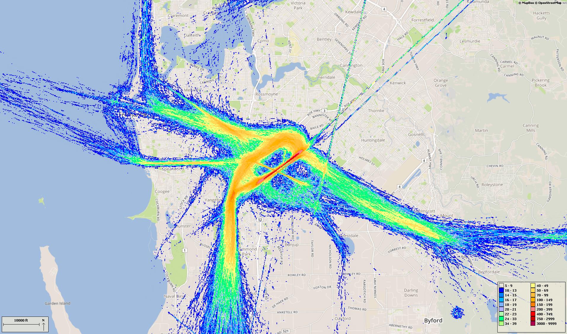
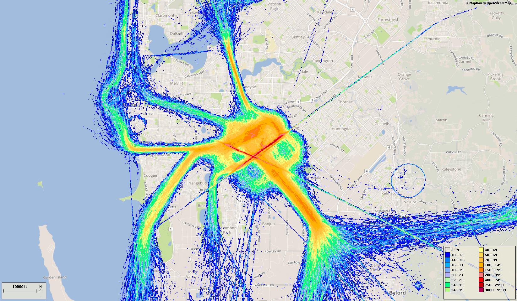
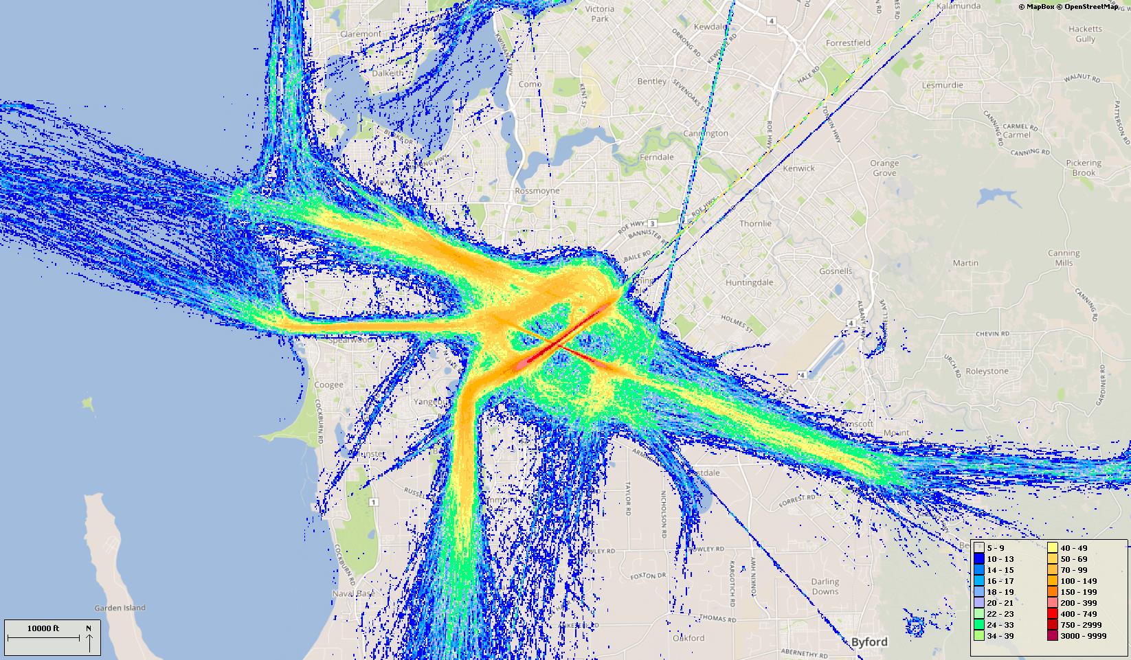
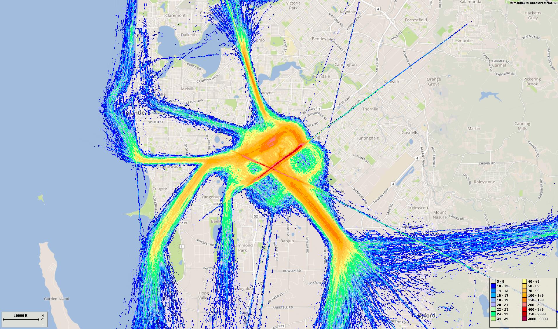
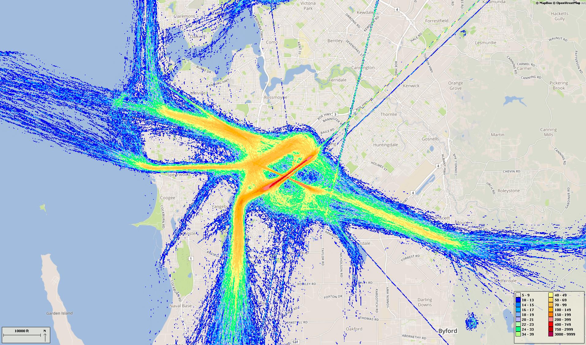
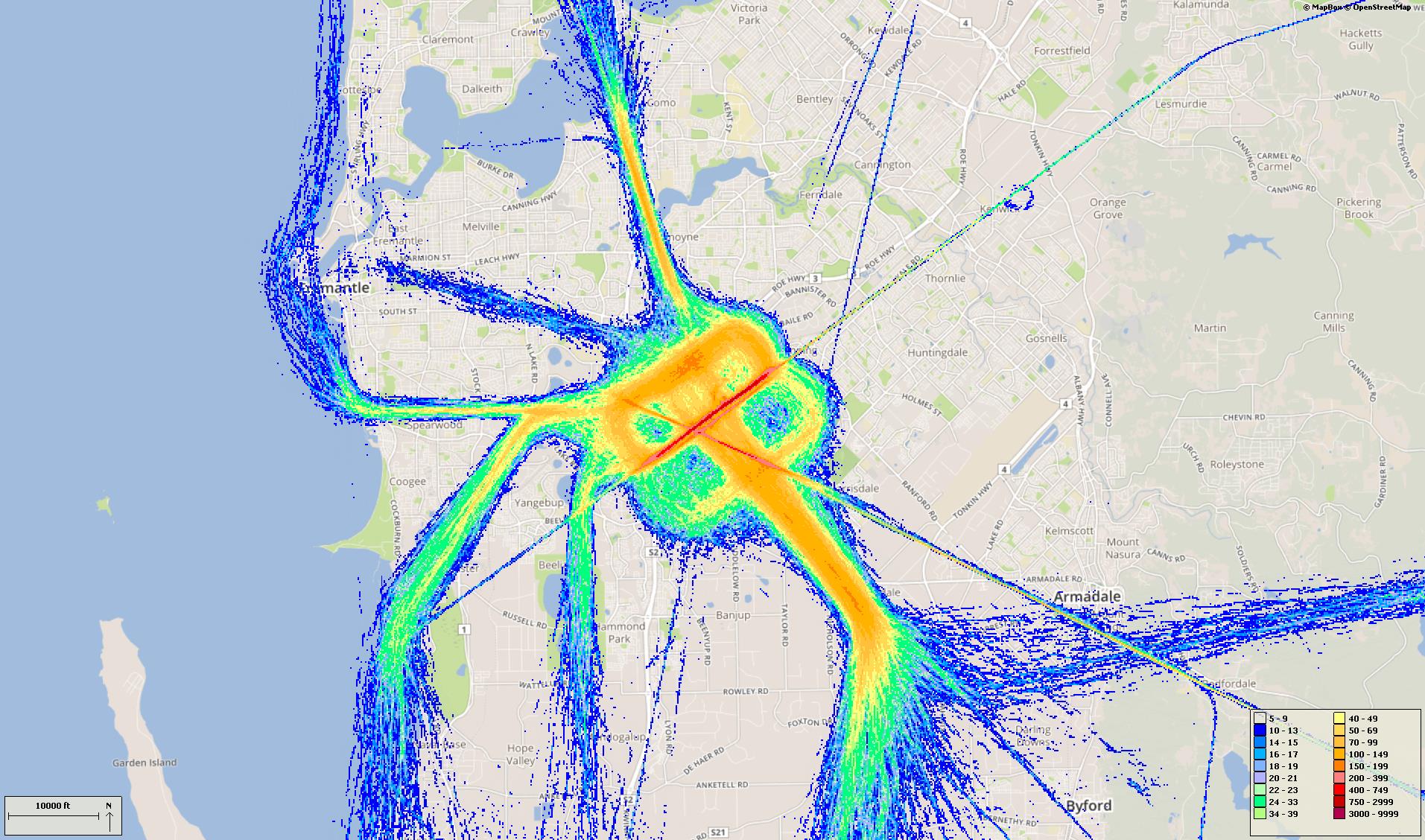
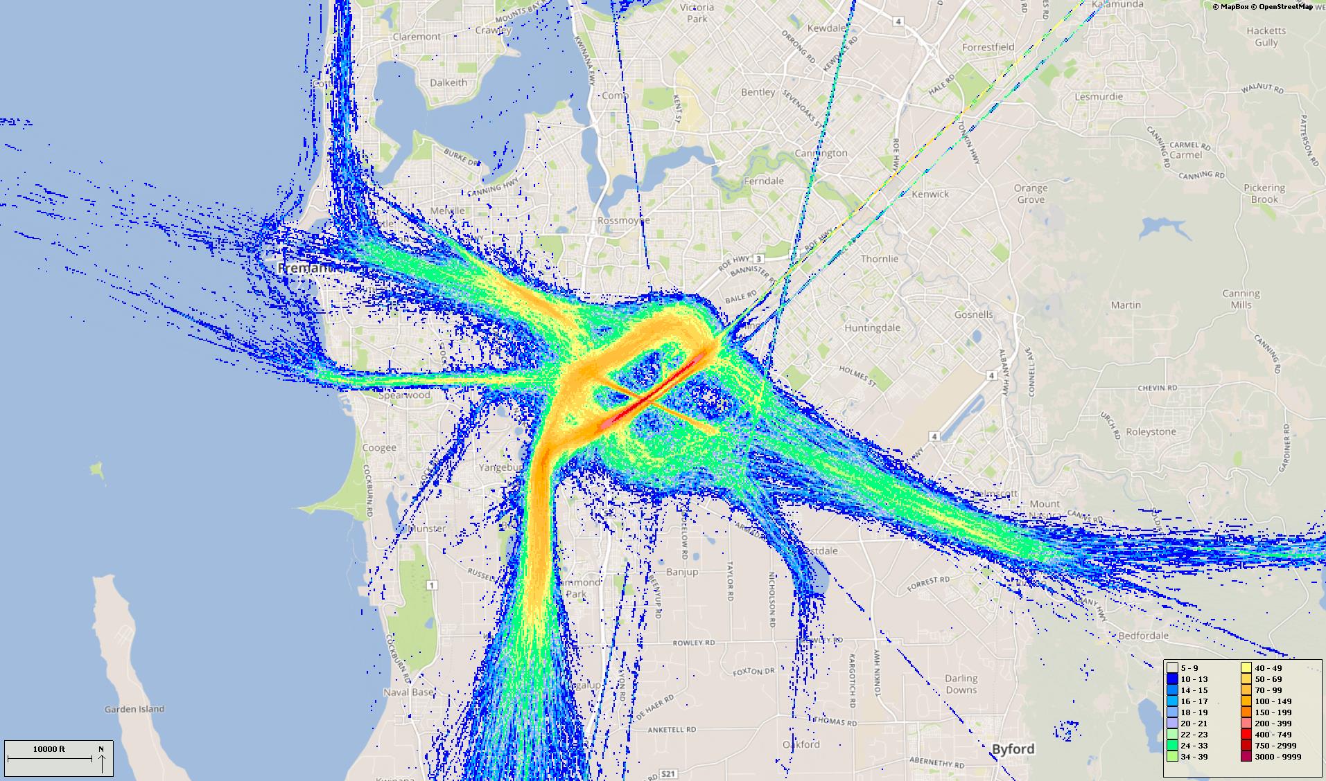
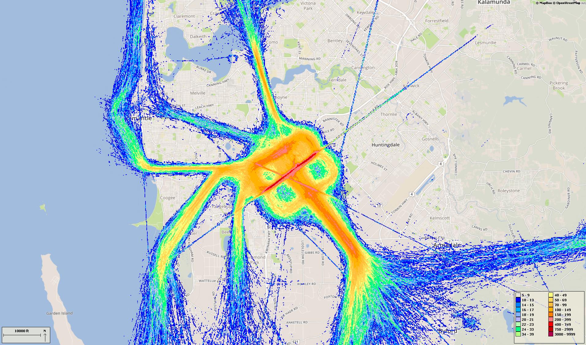
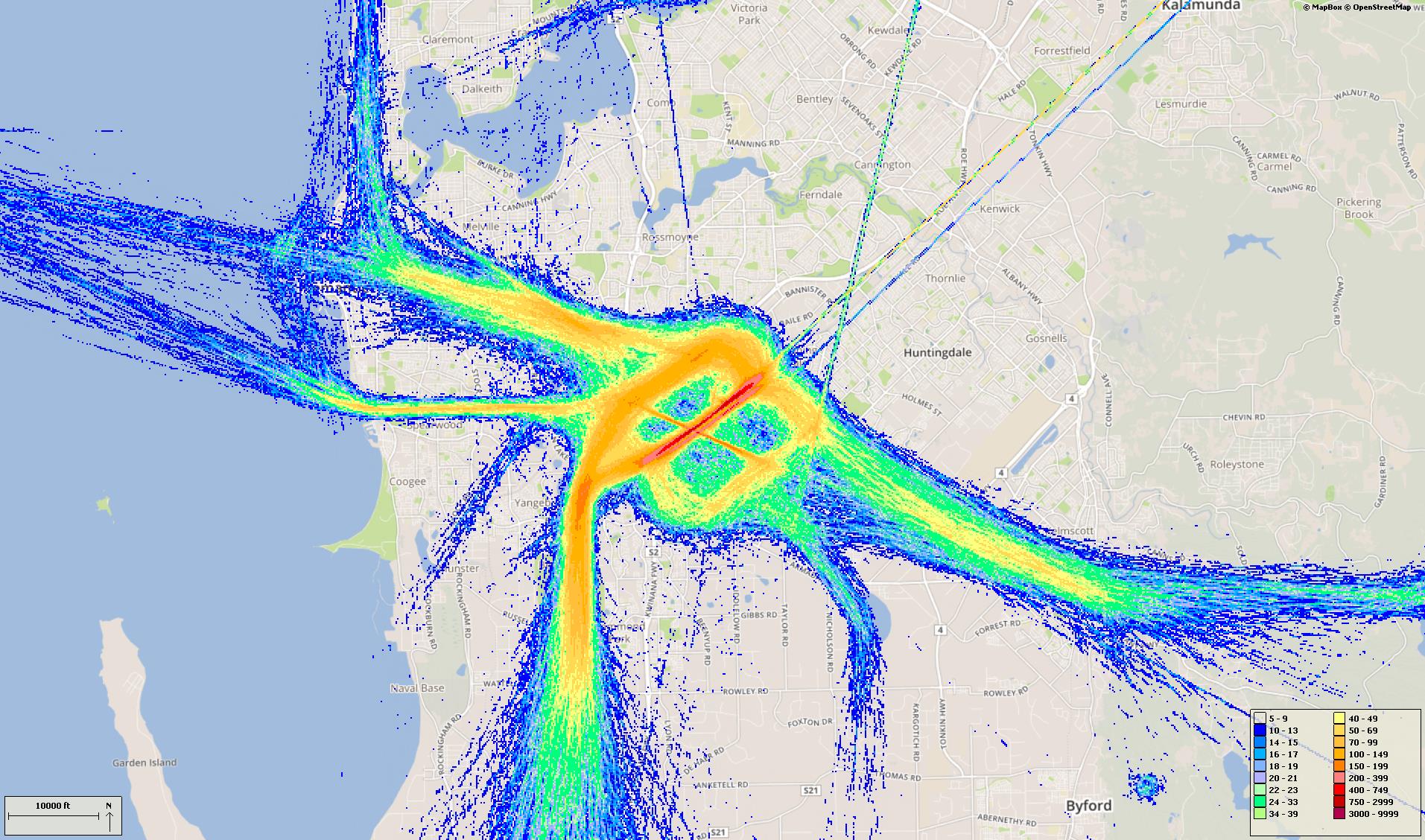
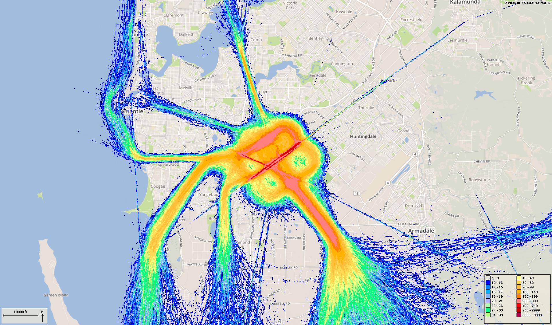
Select a quarter to see track density plots of movements on arrival and departure routes. In these images, the hotter and deeper the colour, the more movements. Click to enlarge and use your “Back” button to return to this page.
Track density – arrivals
Track density – departures
Track density – arrivals
Track density – departures
Track density – arrivals
Track density – departures
Track density – arrivals
Track density – departures
Track density – arrivals
Track density – departures
Track density – arrivals
Track density – departures
Track density – arrivals
Track density – departures
Track density – arrivals
Track density – departures
Track density – arrivals
Track density – departures
Track density – arrivals
Track density – departures
Track density – arrivals
Track density – departures
Track density – arrivals
Track density – departures
Track density – arrivals
Track density – departures
Track density – arrivals
Track density – departures
Track density – arrivals
Track density – departures
Track density – arrivals
Track density – departures
Track density – arrivals
Track density – departures
Track density – arrivals
Track density – departures
Track density – arrivals
Track density – departures
Track density – arrivals
Track density – departures
Track density – arrivals
Track density – departures
Track density – arrivals
Track density – departures