Flight Paths
The majority of aircraft using Parafield Airport fly under Visual Flight Rules (VFR). There are designated routes for VFR aircraft to ensure that VFR traffic remains separate from aircraft flying under Instrument Flight Rules (IFR). It is not mandatory that VFR aircraft fly these routes, but many do, especially as they approach or depart airports.
These routes are outside controlled airspace (“OCTA”), that is, aircraft are not being directed by air traffic control. Whenever they fly outside controlled airspace, pilots are following the rules of the air. More information about airspace is found here.
VFR routes include defined entry and exit points to and from controlled airspace such as that around Parafield Airport. These are landmarks that are easily seen by the pilot from the air. These landmarks are highlighted in the images below, which also show the average percentage of arrivals or departures that use the route.
There is no minimum altitude for aircraft in the process of landing. Aircraft will generally descend on a glide slope of three degrees.
The altitude of aircraft after departure will depend on factors such as the type of aircraft and its weight, how heavily laden it is with fuel and passengers, and the atmospheric conditions at the time. All these factors affect an aircraft’s climb rate. There is no regulated minimum altitude for an aircraft in the process of taking off.
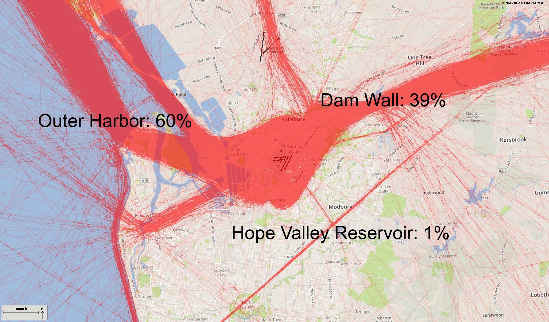
The VFR arrival route from the northwest begins at Dublin. Aircraft will be at or below 4500 feet at this point. The route crosses the coast at River Mouth by which time aircraft must not be above 1500 feet. The route then tracks over water to the entry point at Outer Harbor.
From the east aircraft track via Warren Reservoir where they will be below 2500 feet to Little Para Reservoir Dam Wall entry point where they need to be 1500 feet.
From the south the VFR route begins at Tailem Bend and tracks via Strathalbyn where aircraft will be below 4500 feet. It then proceeds to Port Noarlunga where aircraft will stay below 2500 feet. From there aircraft will track up the coast to the Marino Lighthouse. Aircraft will now be at 1500 feet as they fly past the Mitsubishi Car Plant to the Waite Campus of Adelaide University, and then to Hope Valley Reservoir entry point.
Outer Harbor and Little Para Reservoir Dam Wall are the most used entry points.
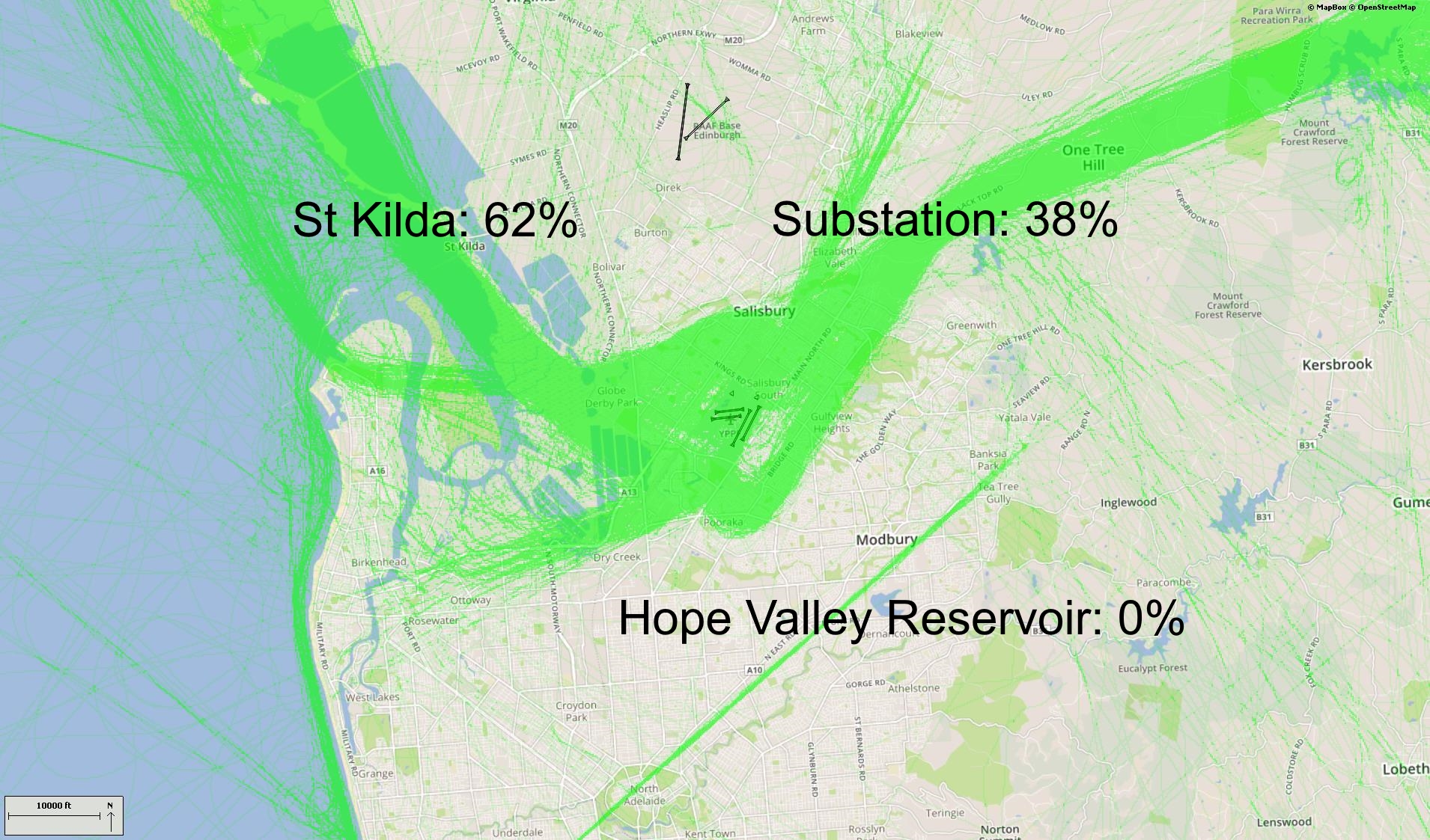
The VFR exit points are Port Adelaide, St Kilda, Para Substation and Hope Valley Reservoir. St Kilda and Para Substation are the most-used exit points.
Aircraft departing to the north-west will maintain 1000 feet until reaching St Kilda to separate them from arriving aircraft at Outer Harbor which are at 1500 feet. To stay out of controlled airspace, aircraft will avoid climbing above 1000 feet until north of St Kilda. While tracking towards Dublin aircraft will climb to 2500 feet until past Middle Beach where they can climb to at or below 4500 feet.
Departures to the east are via Para Substation, past the GMH complex. Aircraft will maintain 1000 feet until clear of traffic and then climb to 1500 feet. Once clear of the Parafield Control Zone they will climb to not above 2500 feet and track to South Para Reservoir.
Departures to the south may be cleared by air traffic control on the Hope Valley Reservoir route from Waite Campus at Adelaide University to Marino Lighthouse. Alternatively they may be directed to depart via St Kilda from where further clearance to head south is required.
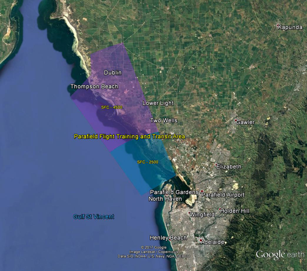
A designated training area exists to the north-west of the airport and to the west and north-west of the RAAF Edinburgh Base. Once pilots progress past the circuit training stage of their courses they will begin flying to and around the training area.
Click to enlarge the image, right, and use your browser “back” button to return to this page.
The training area is outside controlled airspace. It extends from St Kilda, which is approximately 10 kilometres west-north-west of the airport, to Long Plains, which is a further 45 kilometres to the north-west of St Kilda. The training area is to the west of this line and extends to 9 kilometres off the coast. It is ‘wedge-shaped’ because it is located in-between military restricted airspace to the west and north and the RAAF Edinburgh Base Control Zone to the east.
From the St Kilda area to just south of Middle Beach the training area exists between the surface (“SFC”) and 2500 feet. North to Long Plains the area extends between the surface and 4500 feet. These levels keep the aircraft below controlled airspace; therefore aircraft do not need a clearance from air traffic control to operate in the training area.
Aircraft wishing to track to the training area from Parafield Airport must remain south of the Bolivar strobe light and west of St Kilda to remain outside controlled airspace. The north- and southbound VFR routes (described above) transit the area.
Activities that may occur inside the training area include parachute operations and light aircraft movements at Lower Light aircraft landing area, as well as training flights by light aircraft in and around the area and aircraft transiting on the north and southbound VFR routes. There can be increased traffic volumes in the area due to use by flight training companies from Parafield Airport and because all aircraft are confined to a relatively small area due to the surrounding military airspace including RAAF Base Edinburgh.
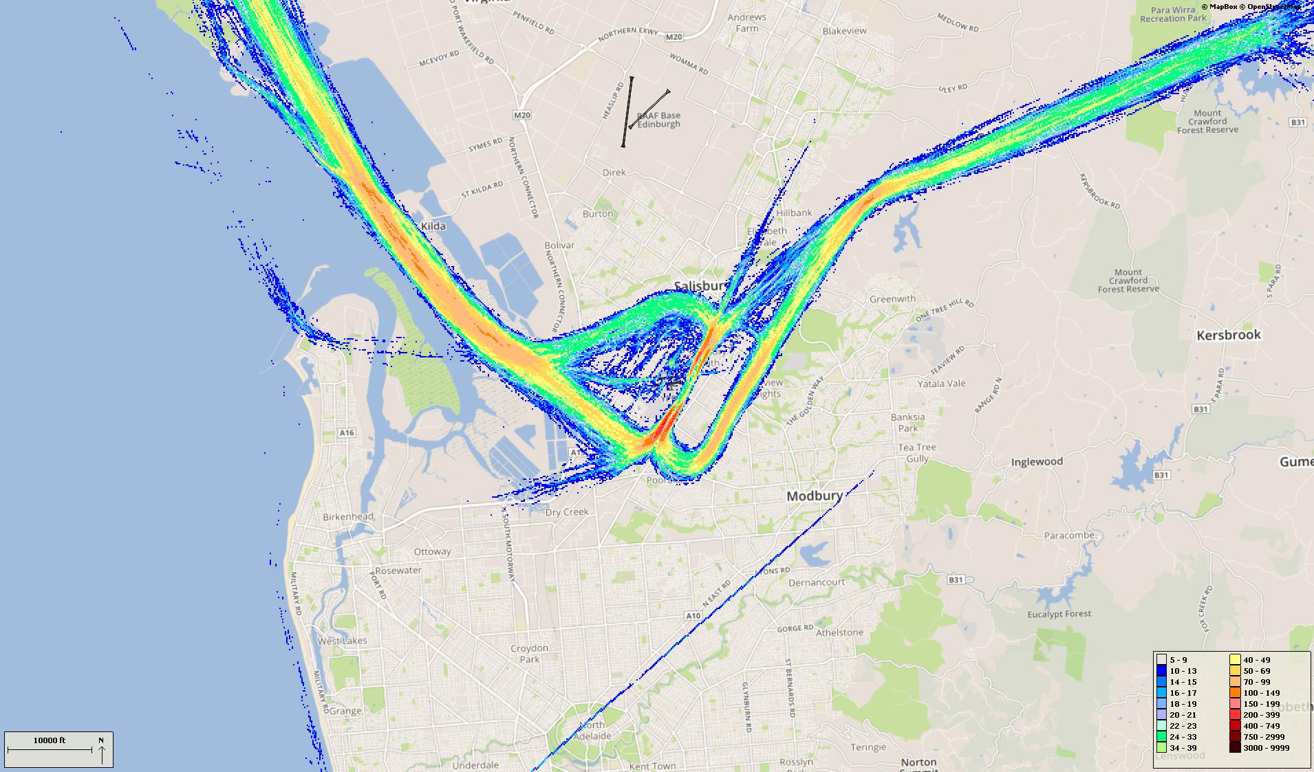
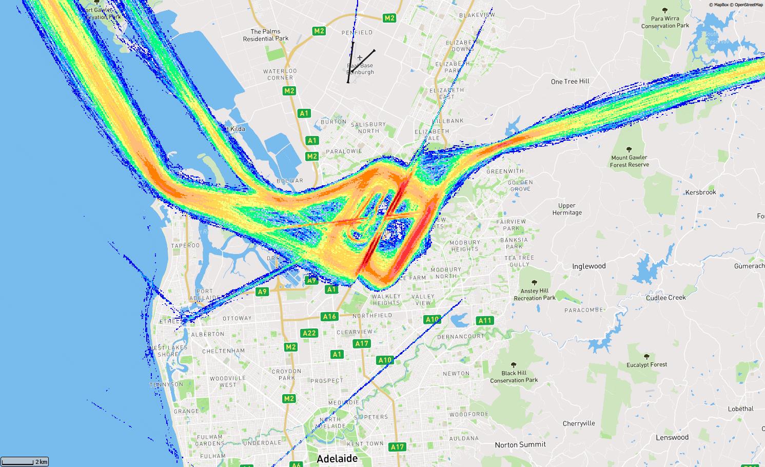
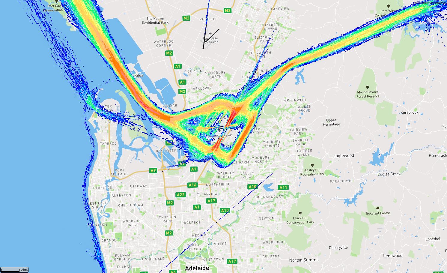
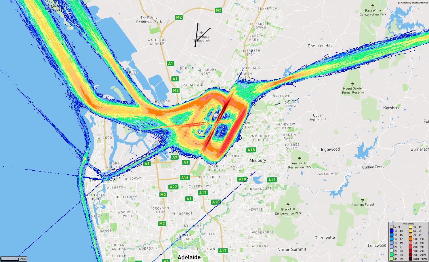
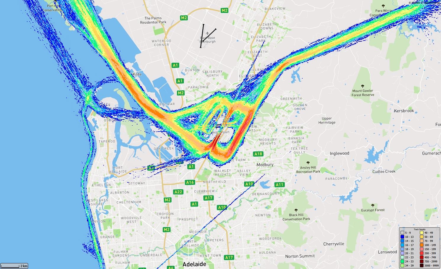
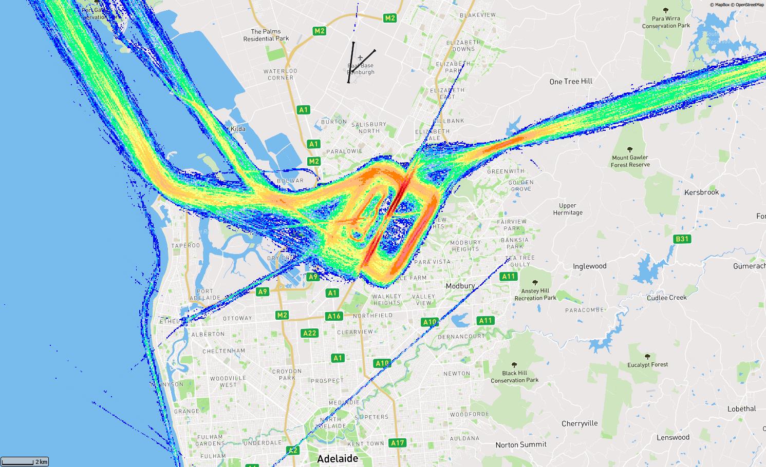
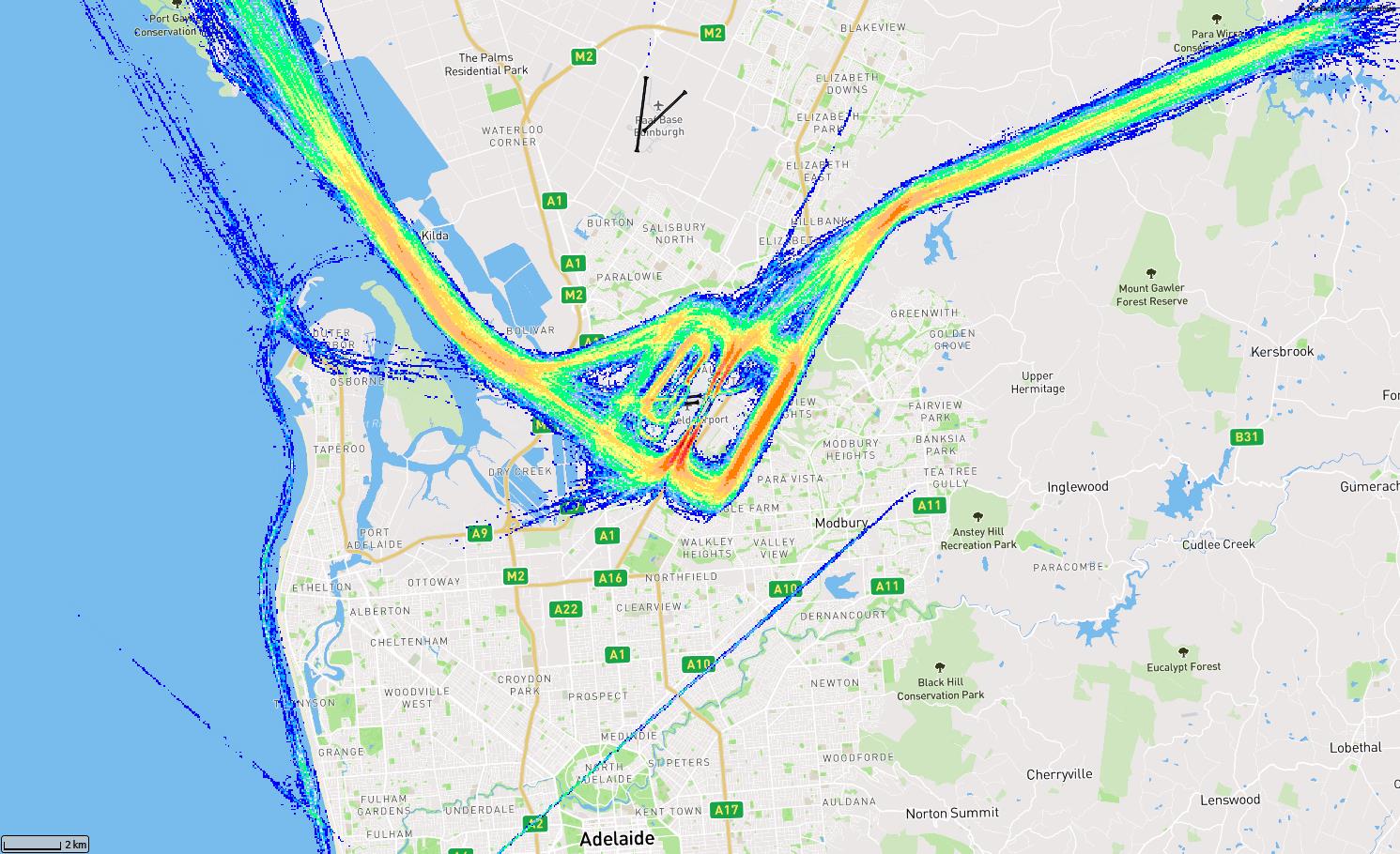
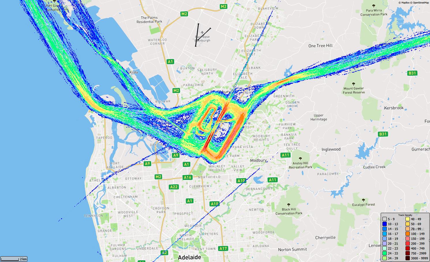
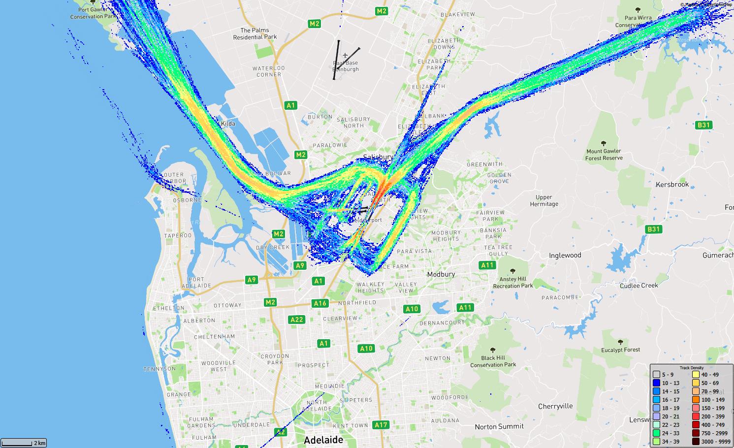
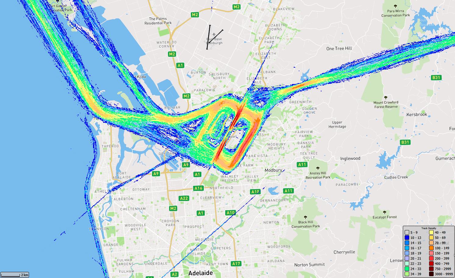
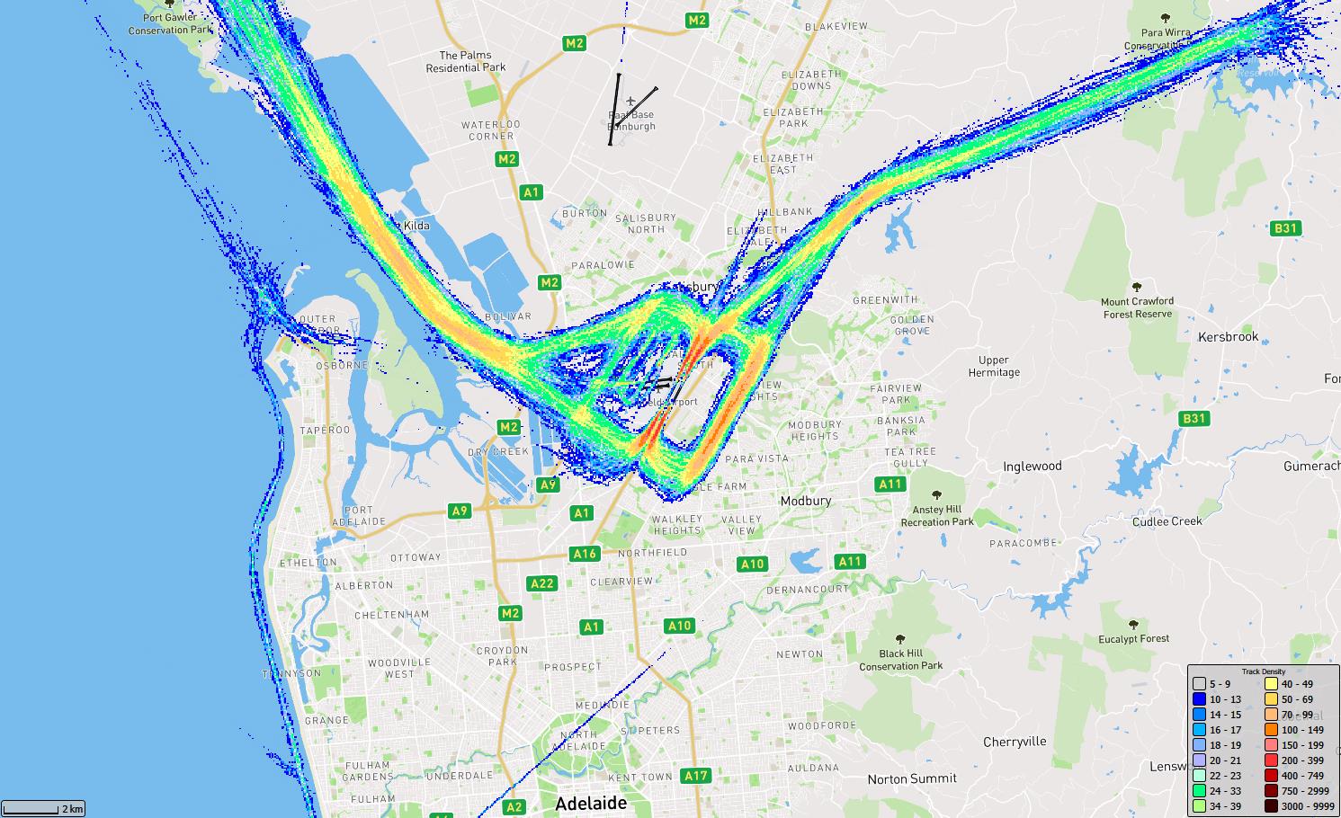
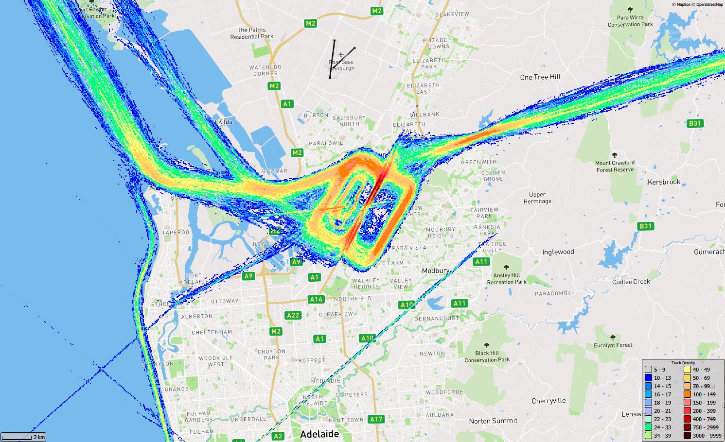
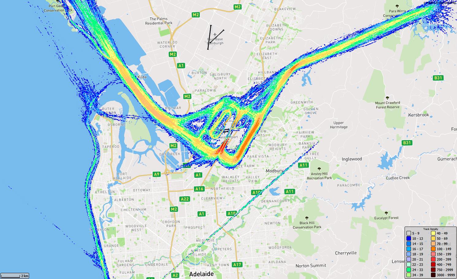
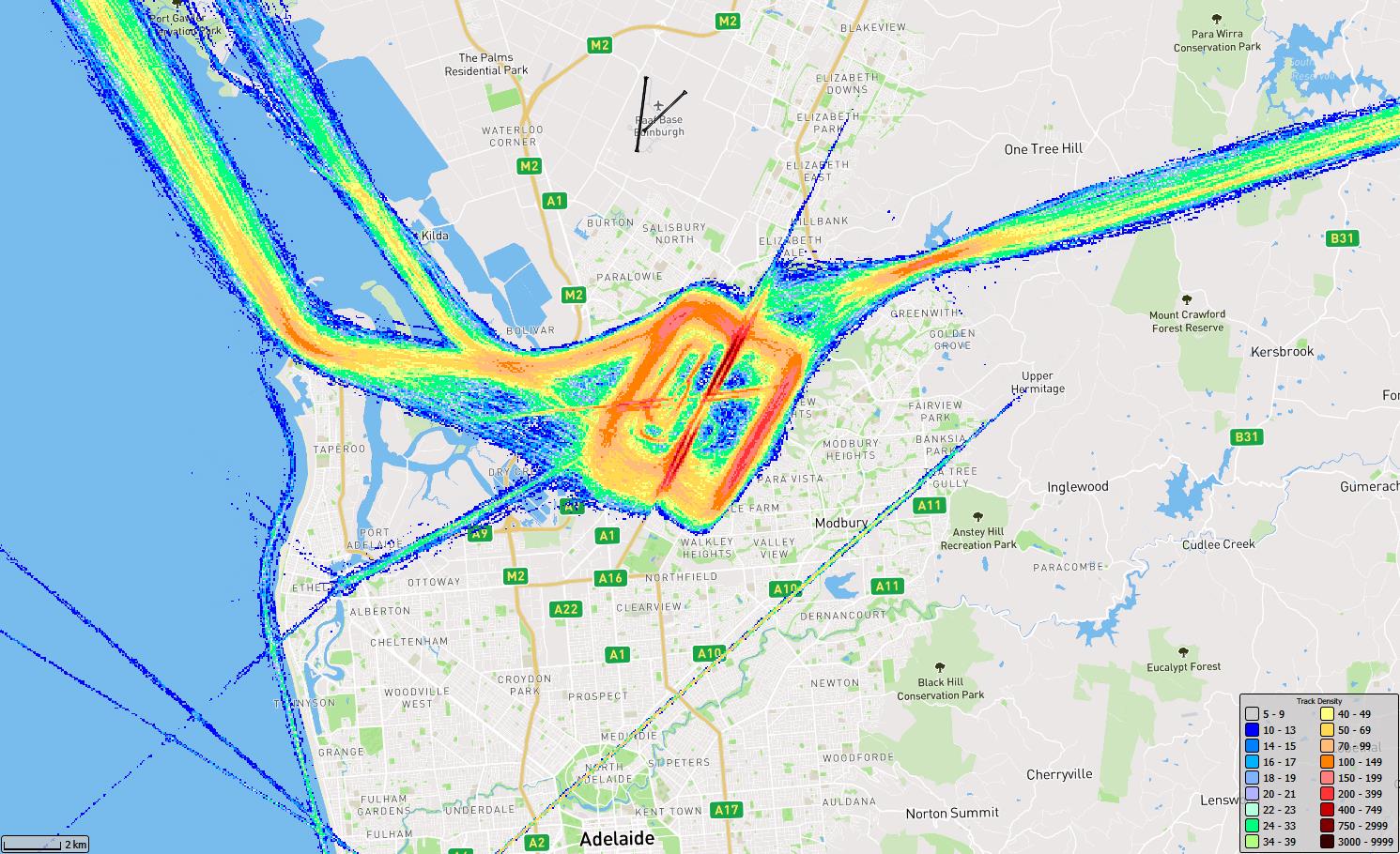
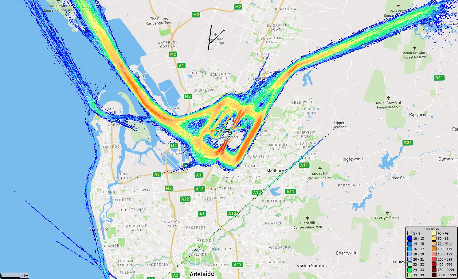
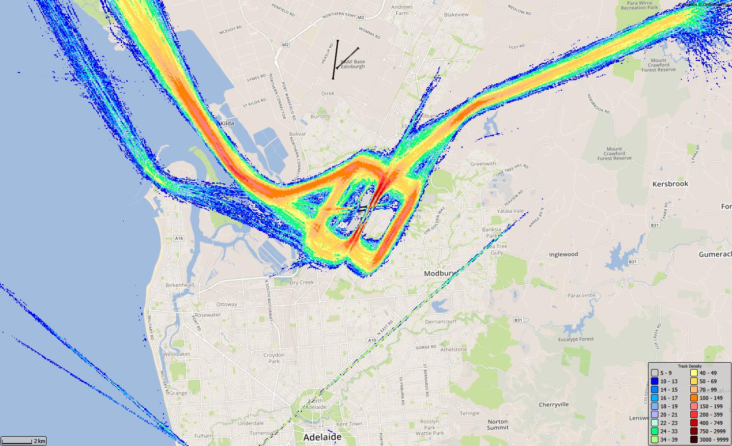
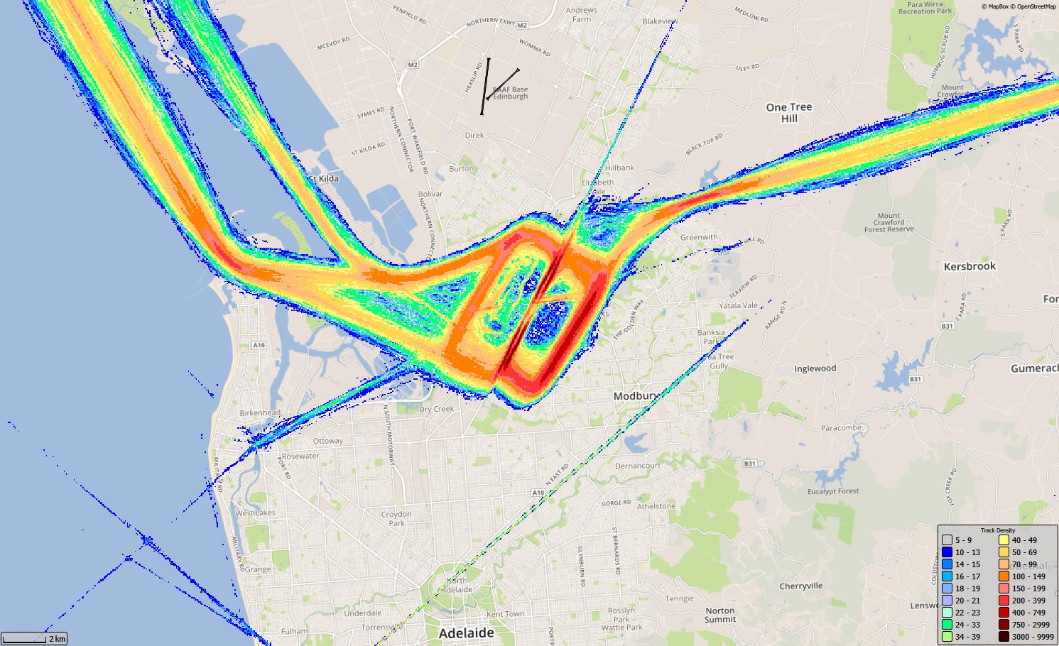
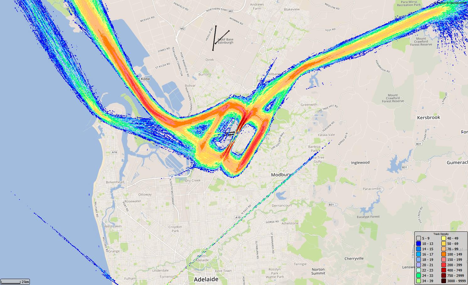
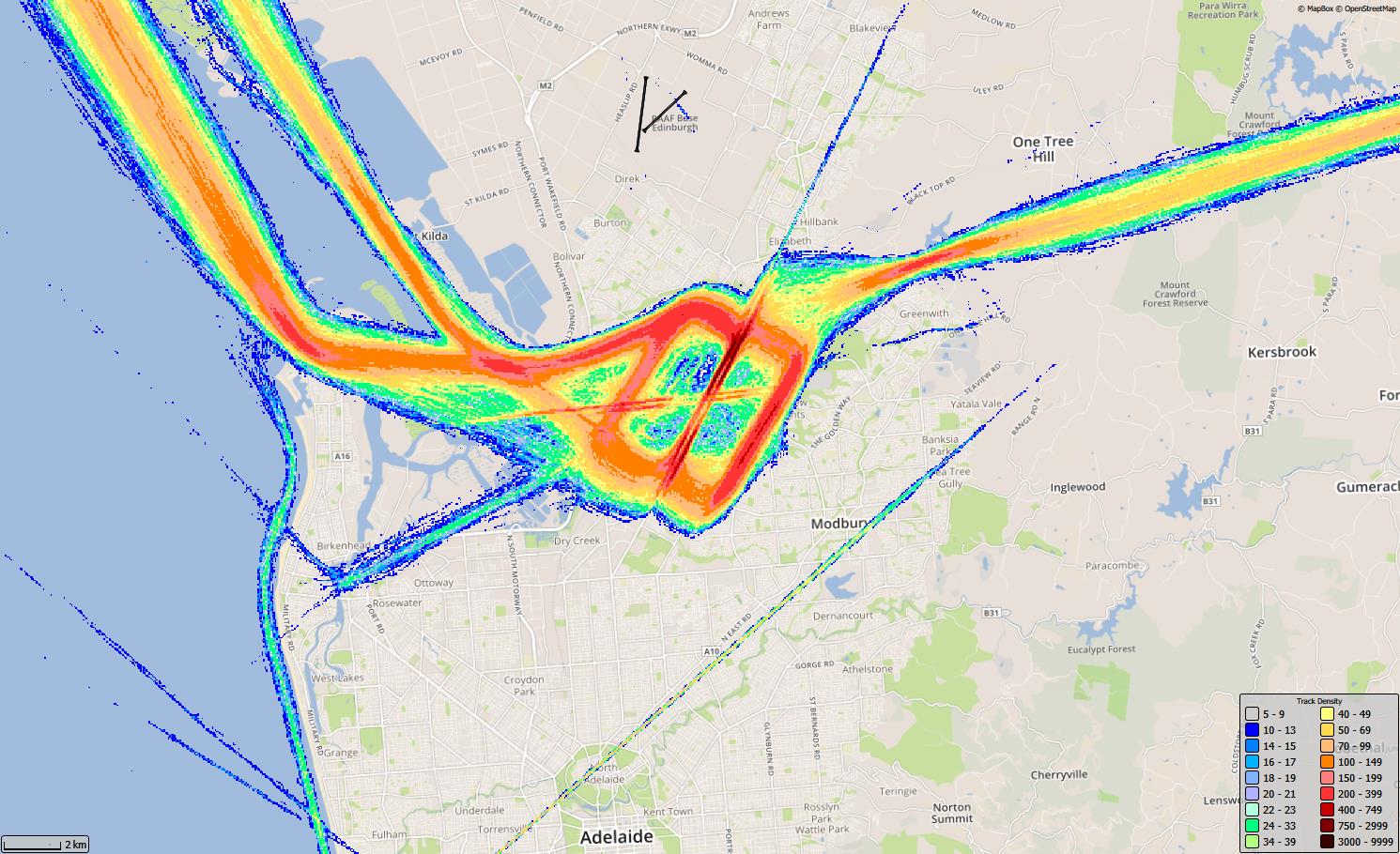
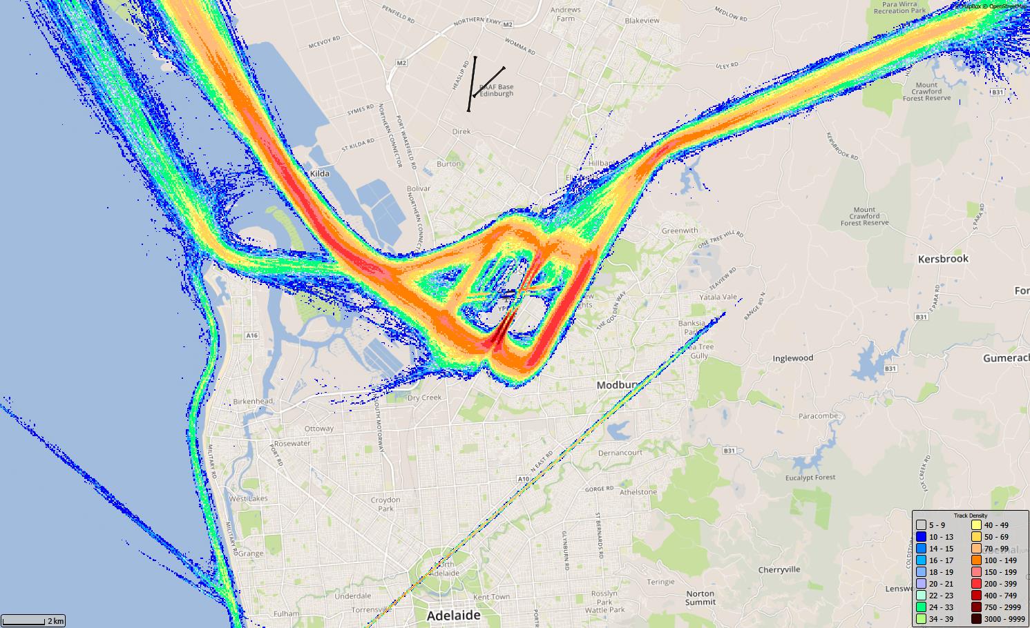
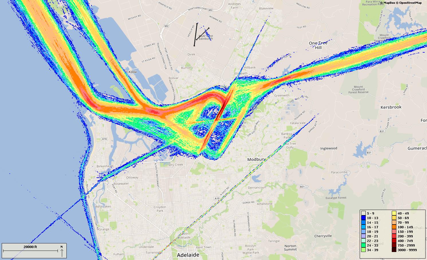
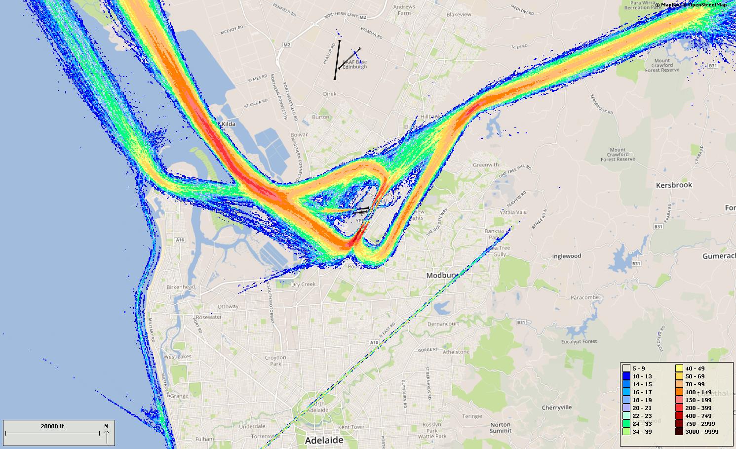
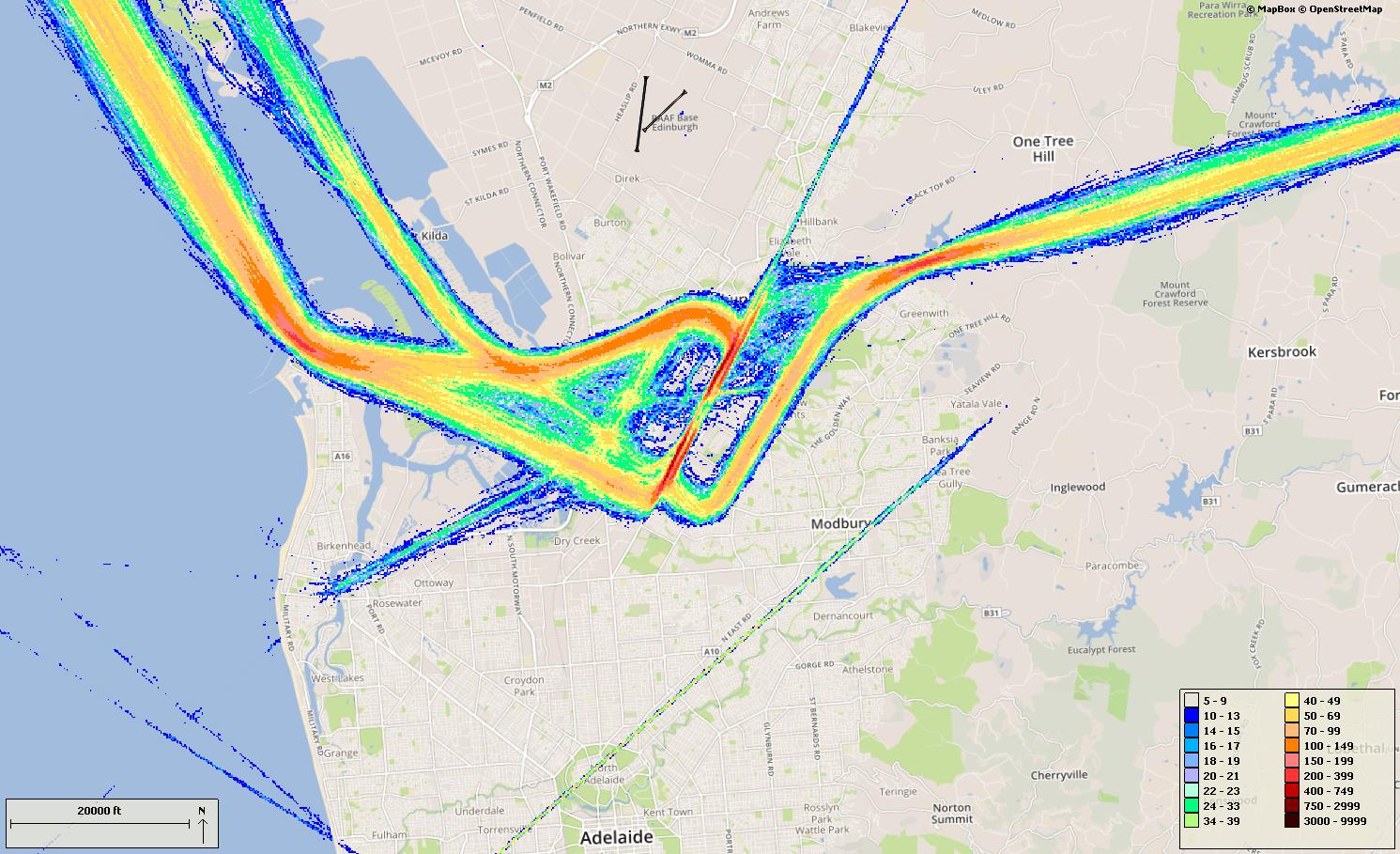
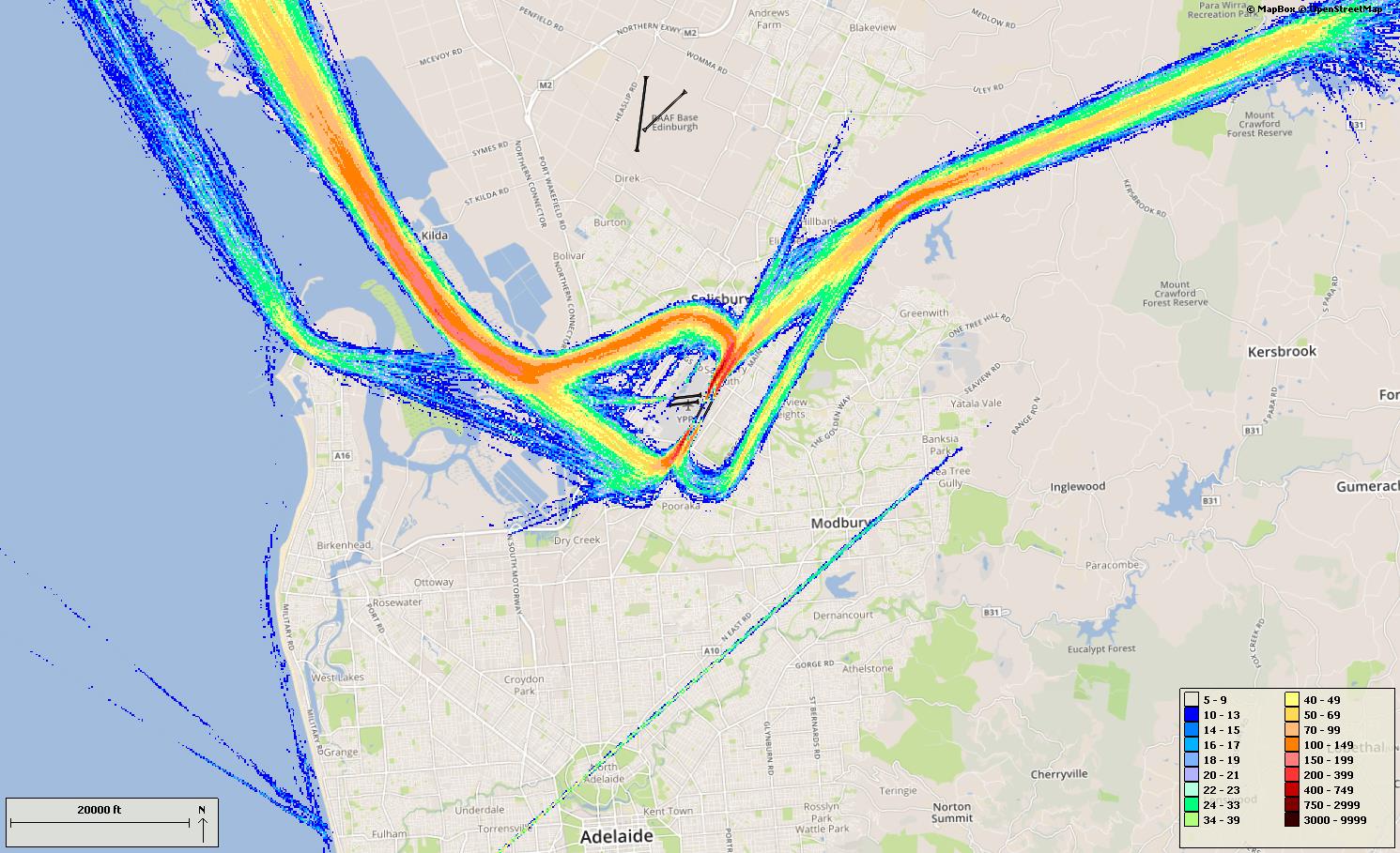
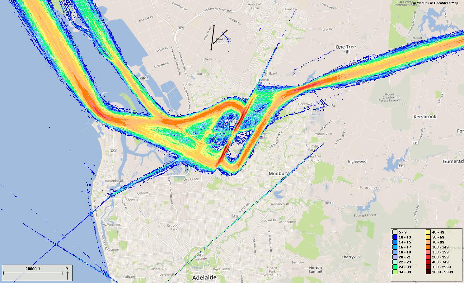
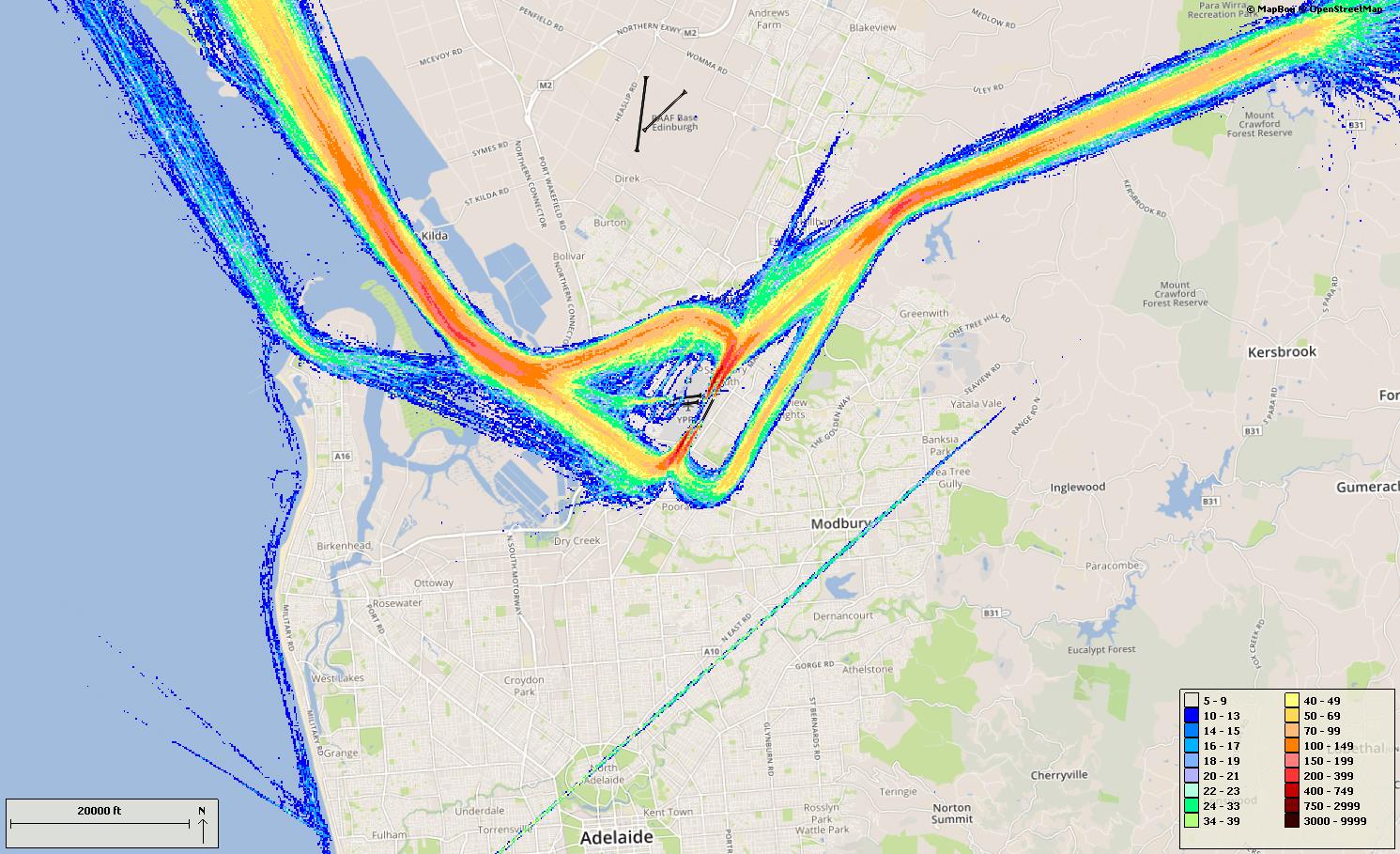
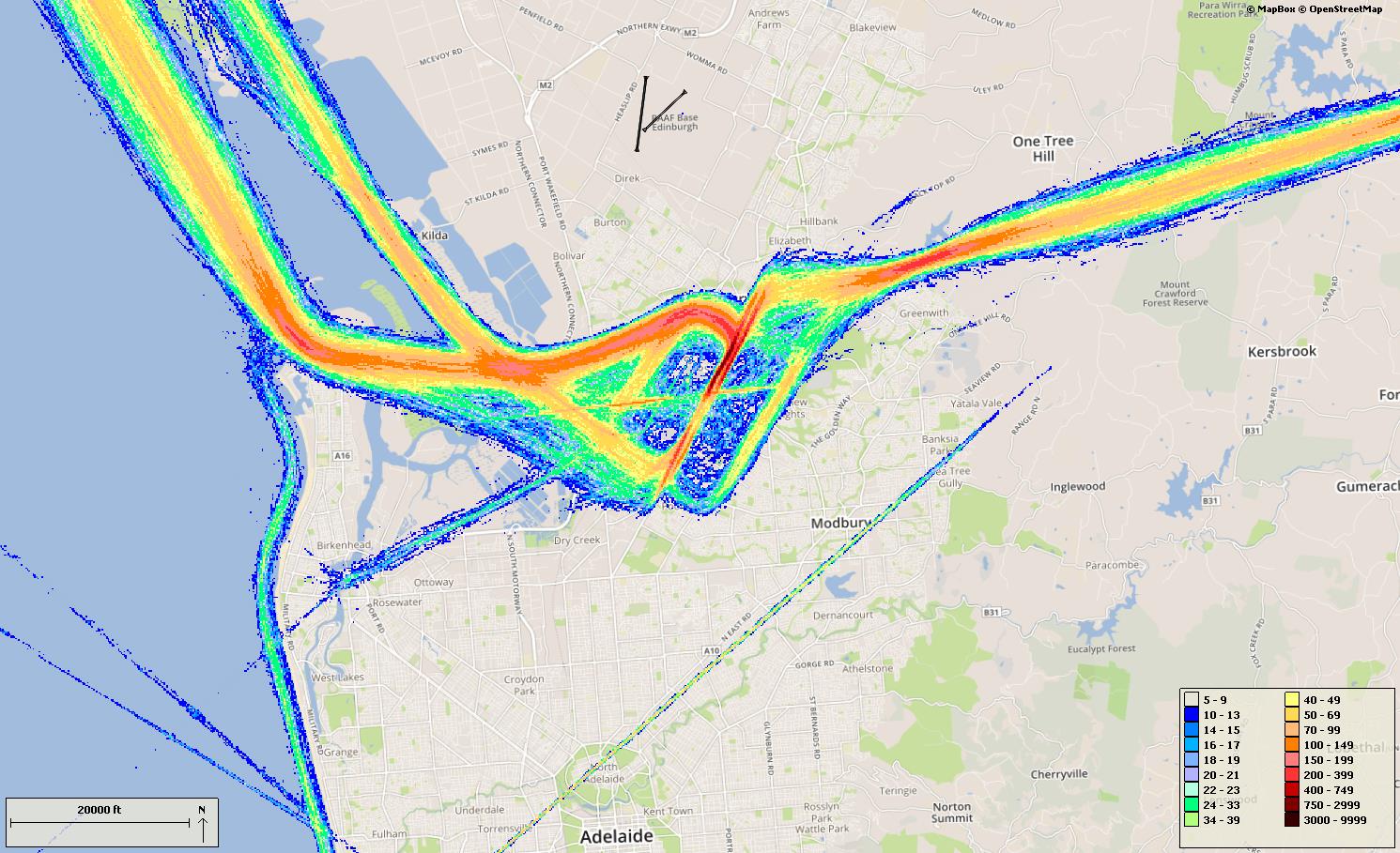
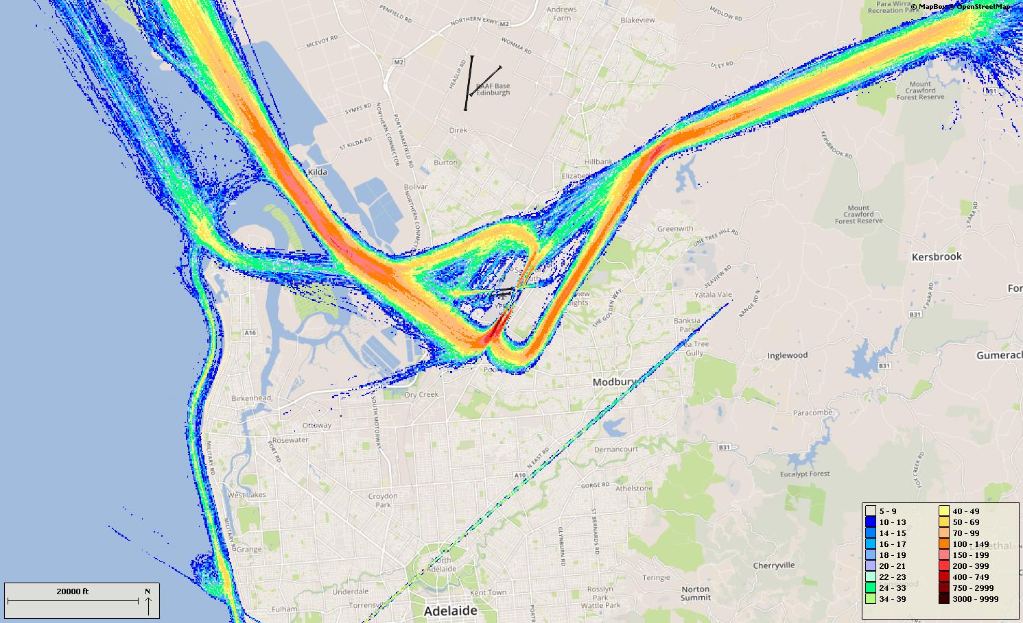
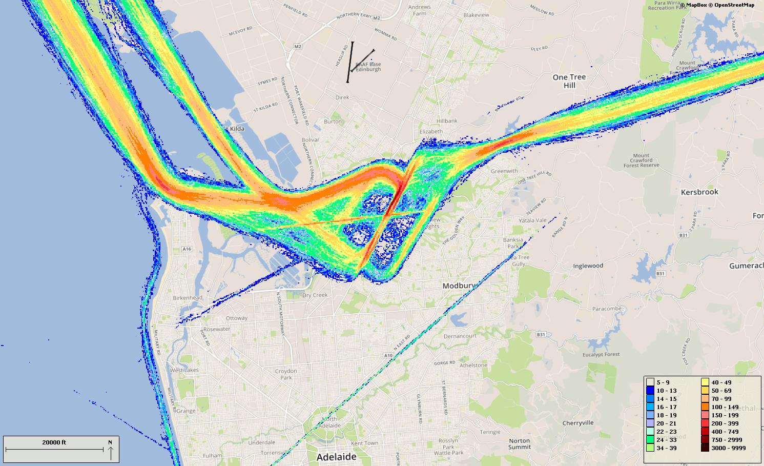
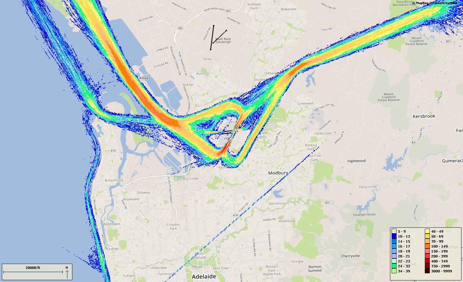
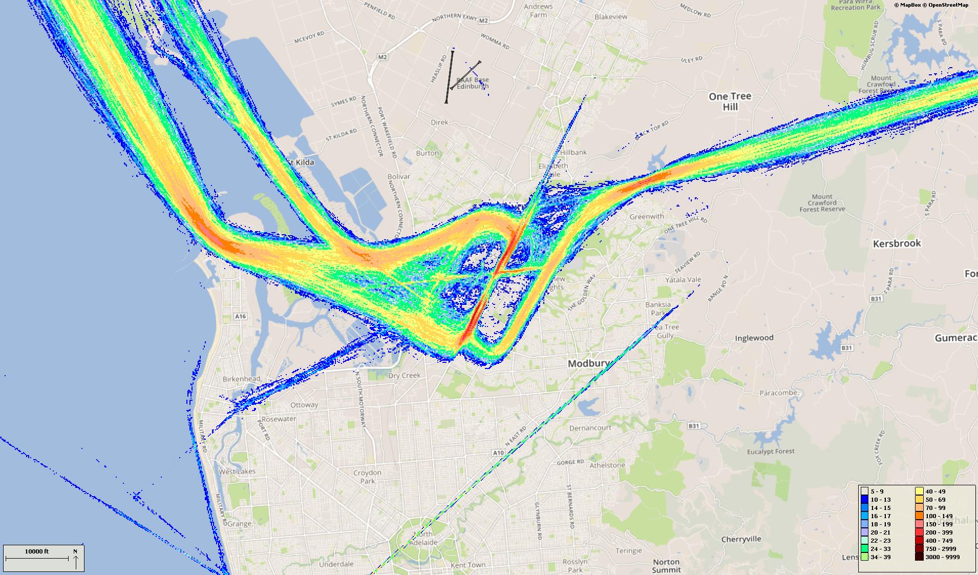
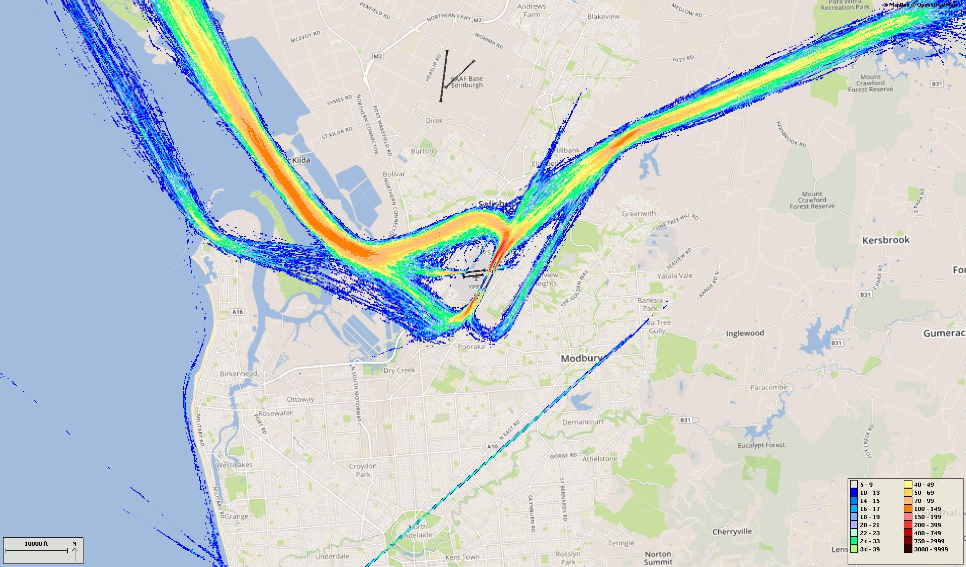
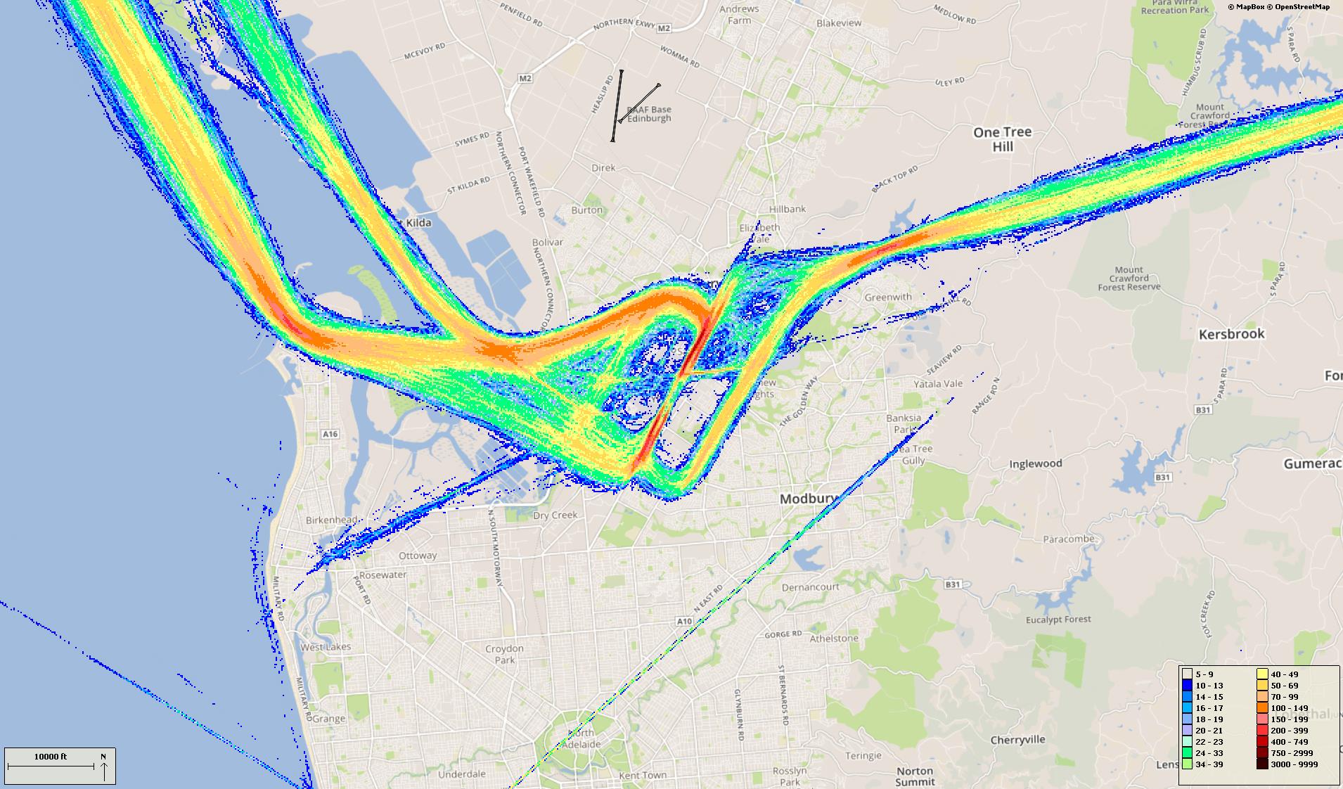
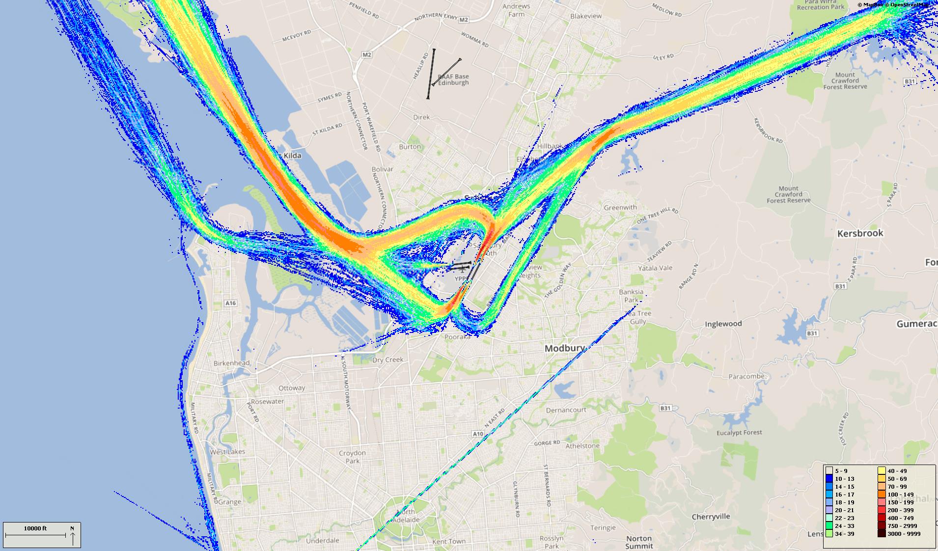
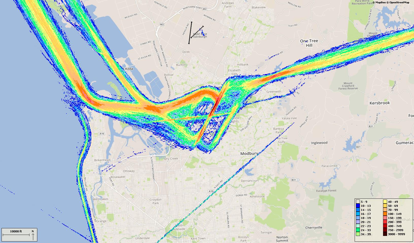
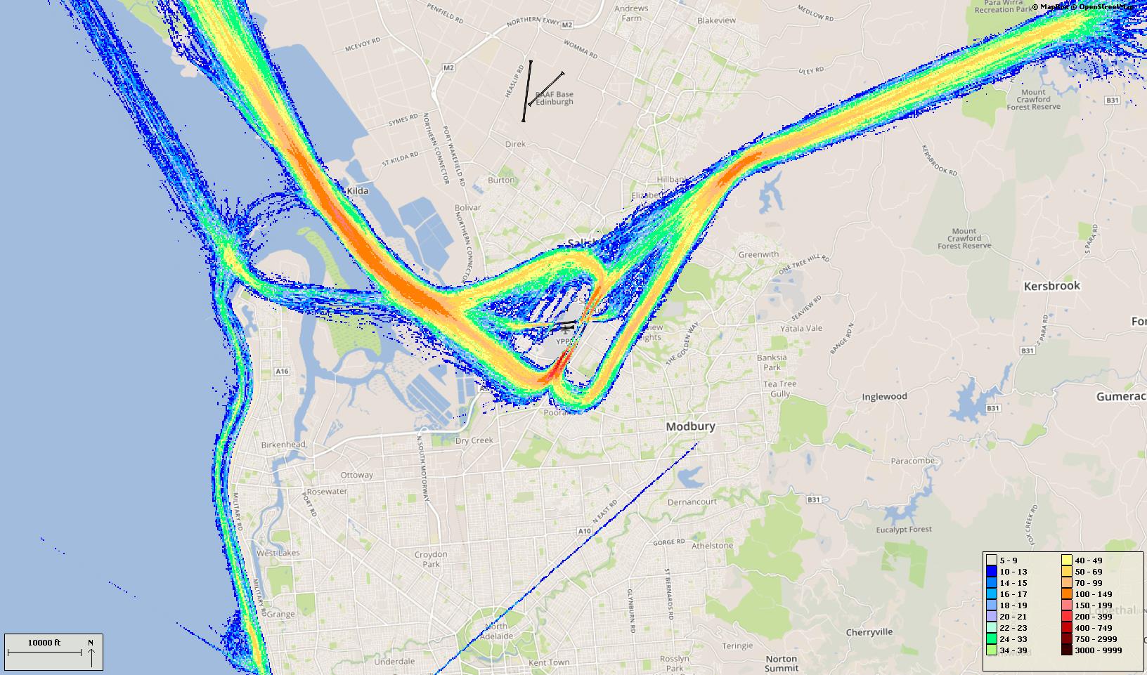
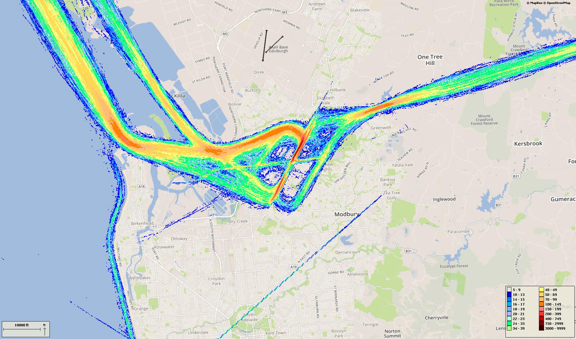
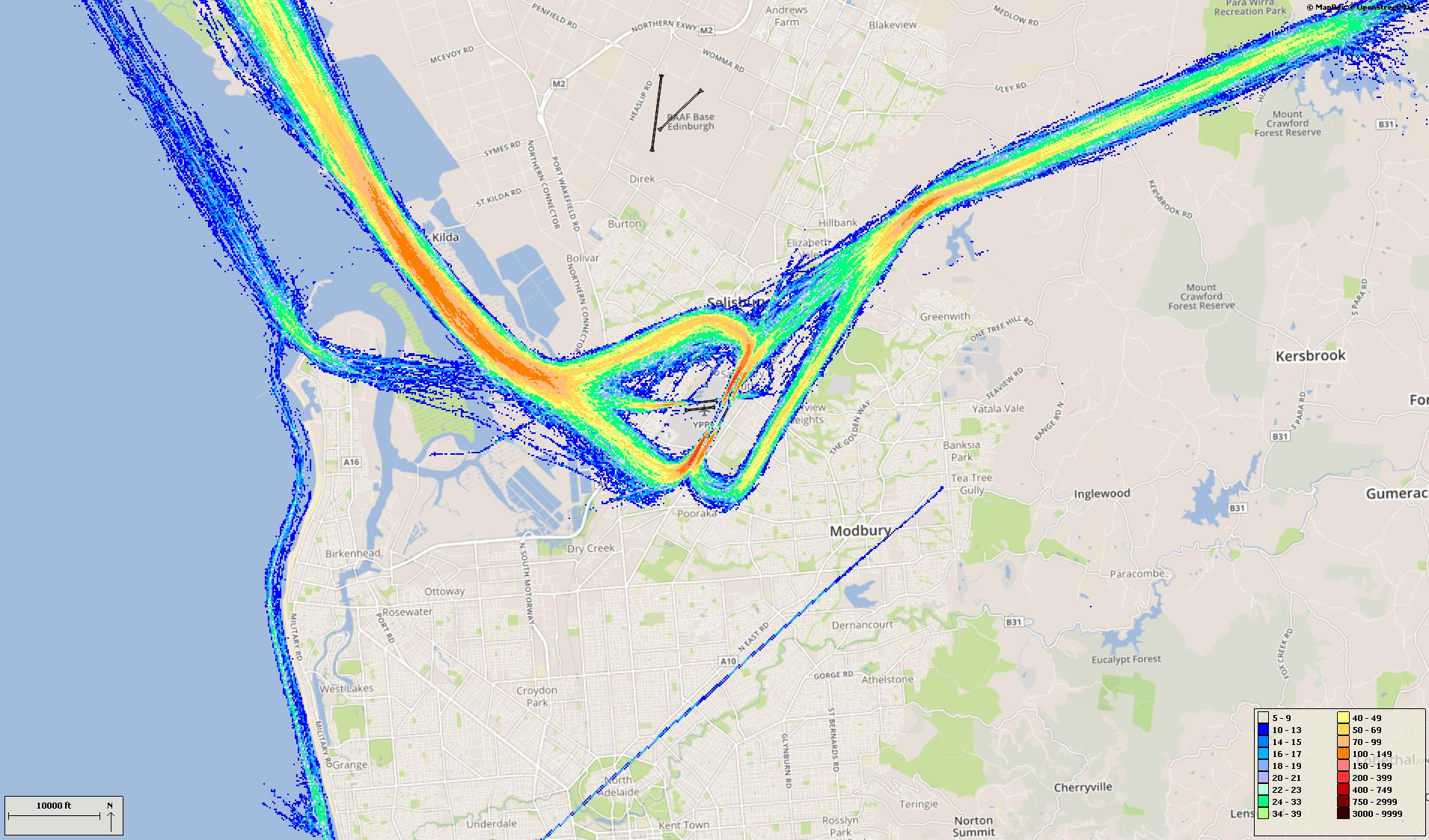
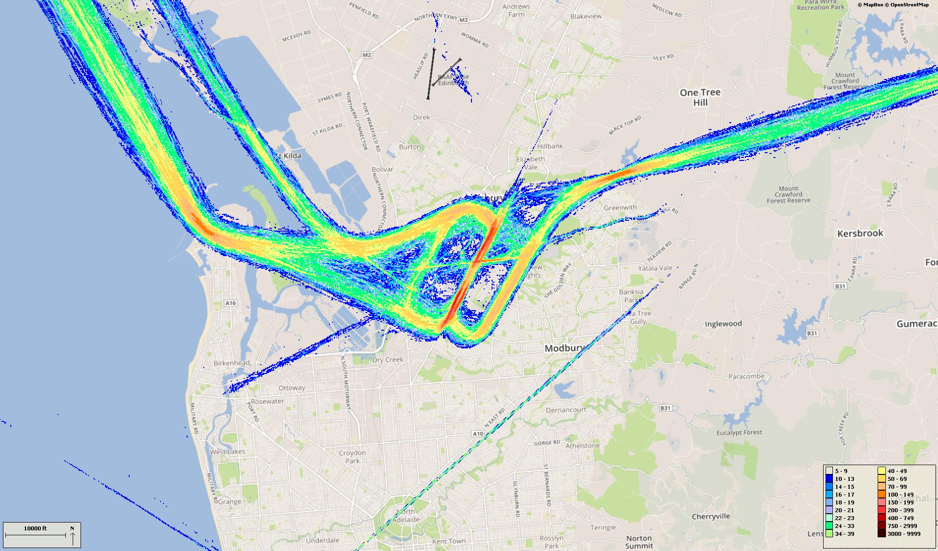
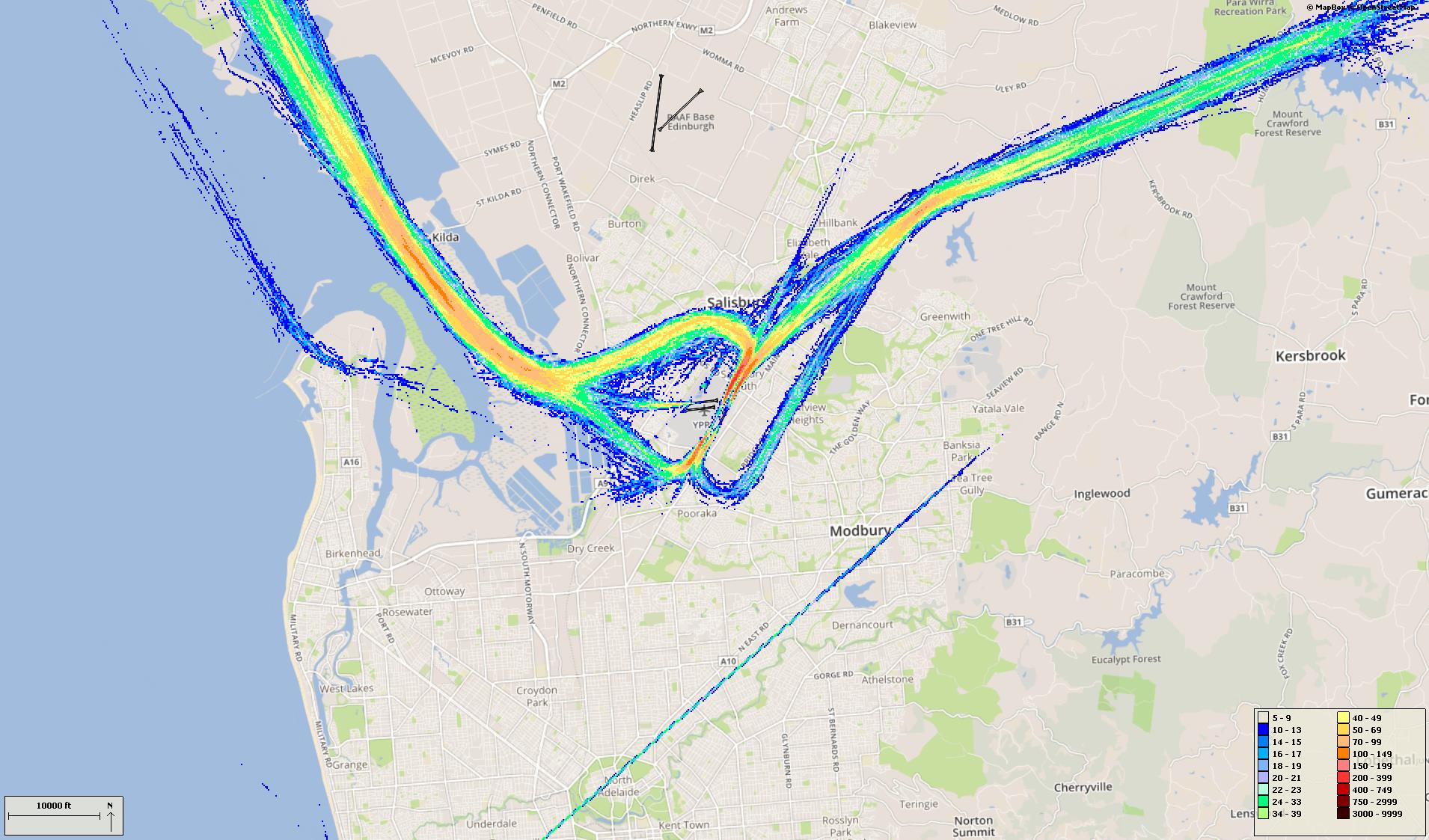
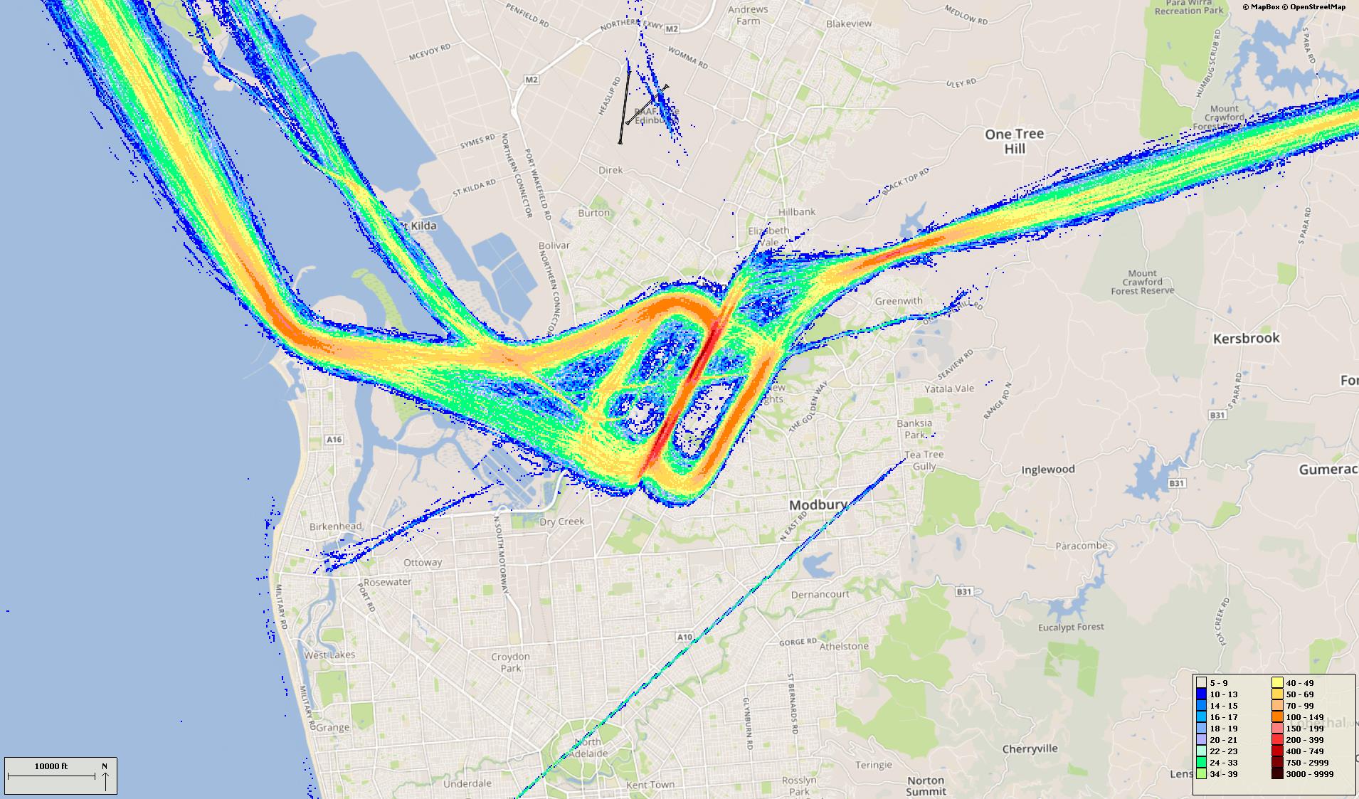
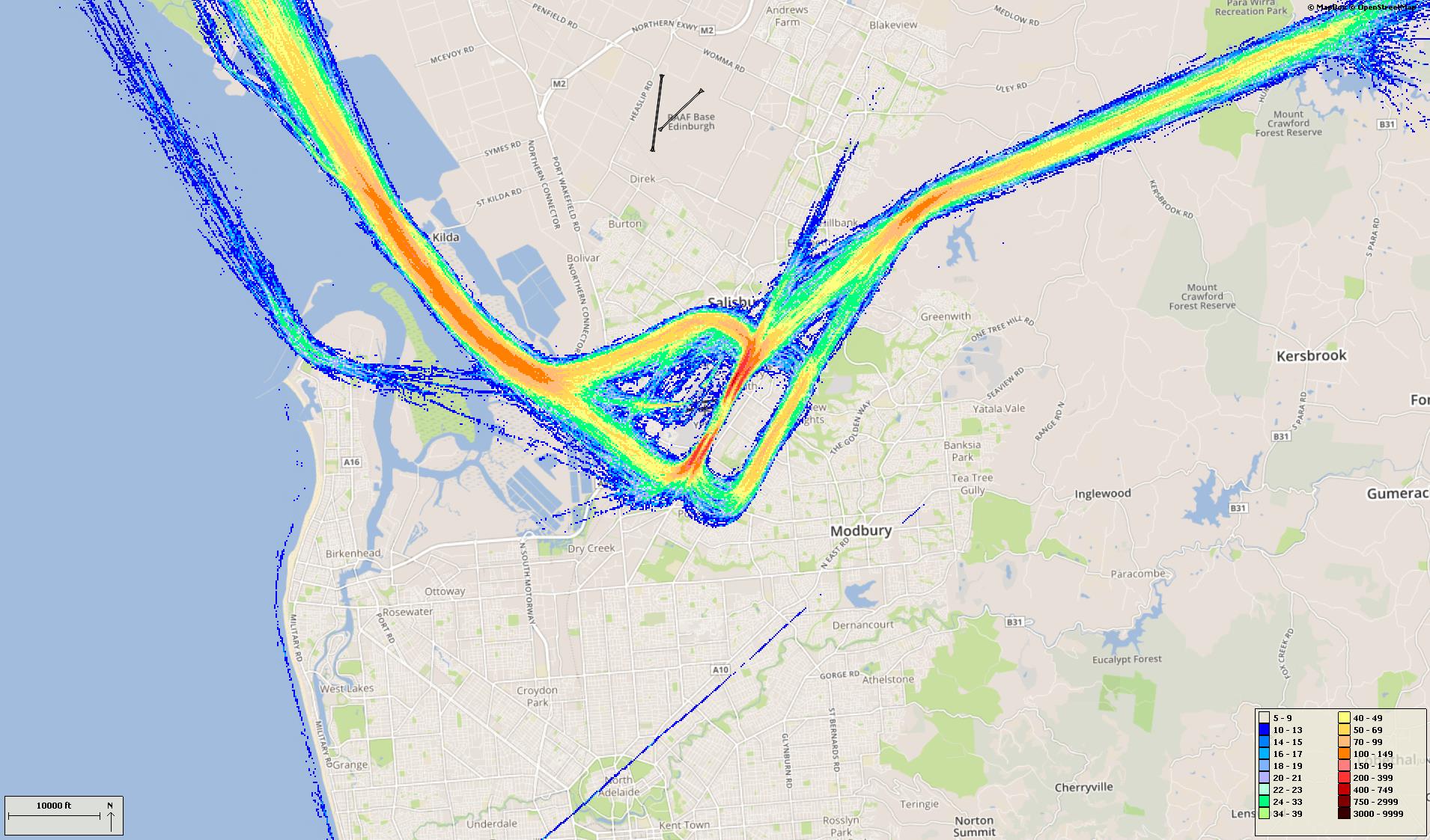
Select a quarter to see track density plots of movements on arrival and departure routes. In these images, the hotter and deeper the colour, the more movements. Click to enlarge and use your “Back” button to return to this page.
Track density – arrivals
Track density – departures
Track density – arrivals
Track density – departures
Track density – arrivals
Track density – departures
Track density – arrivals
Track density – departures
Track density – arrivals
Track density – departures
Track density – arrivals
Track density – departures
Track density – arrivals
Track density – departures
Track density – arrivals

Track density – departures
Track density – arrivals
Track density – departures
Track density – arrivals
Track density – departures
Track density – arrivals
Track density – departures
Track density – arrivals
Track density – departures
Track density – arrivals
Track density – departures
Track density – arrivals
Track density – departures
Track density – arrivals
Track density – departures
Track density – arrivals
Track density – departures
Track density – arrivals
Track density – departures
Track density – arrivals
Track density – departures
Track density – arrivals
Track density – departures
Track density – arrivals
Track density – departures
Track density – arrivals
Track density – departures
Track density – arrivals

Track density – departures